Project Description: The project included the complete reconstruction of the system to system interchange at I-465 and I-74. It also reconstructed the interchange access from I-465 to Brookville Road and Shadeland Avenue. The interchange configuration involved extensive coordination with geotechnical to determine the most cost-effective solutions for the fly-over ramps. It was determined in that longer bridges were more economical than walls due to the existing soil conditions. Maintenance of Traffic was a major component of the design due to the urban environment. Additionally, detention and lift station designs were completed as part of the project to facilitate drainage.
Approximate Project Cost: $74,000,000
Breadth of Services Provided: Regulatory Permit Applications, Roadway Design, and Bridge Design
Project Description: The Ronald Reagan Parkway is multi-lane rural arterial from I-70 to I-74, near Hendricks County, Indiana. This FAST TRACK project provides transportation services to this rapidly developing portion of eastern Hendricks County and western Marion County. Connection of the corridor to I-74 is a vital part of the overall traffic/congestion management for Hendricks County and the Indianapolis Metropolitan Area.
This project, in development for just six months, included a new diamond Interchange on I-74 in Hendricks County and nearly two-miles of new alignment roadway construction for the County’s five-lane rural Ronald Reagan Parkway corridor from US 136 to 56th Street (CR 600 N).
The interchange is 2.8 miles east of SR 267. The Ronald Reagan Parkway runs from US 136 (Crawfordsville Road), north to Hendricks County Road 600 North (56th Street).
Approximate Project Cost: $18,000,000
Breadth of Services Provided: Roadway Design, Right-of-Way Engineering, Utility Coordination, Lighting Design, Hydraulic Design, and Permitting
Project Description: This project was the replacement of Sullivan County Bridge No. 297 carrying CR 900 North over Busseron Creek in northern Sullivan County. United Consulting performed all field and office work for the initial property research, collection of data, data processing, and property line calculations for the survey. United Consulting also coordinated title searches and provided transfer documents, legal descriptions, land plats, area computations, existing right-of-way documentation, and right-of-way staking for the four properties for which land was acquired for the construction of the new bridge.
Approximate Project Cost: $750,000
Services Provided: Topographic Survey, Design Survey, Right-of-Way Engineering, and Location Control Route Survey
Project Description: The project consisted of the construction of an eight-span, variable depth, reinforced concrete Girder Bridge carrying Carroll CR 250 W over the Wabash River. Project also included a new widened deck slab, end bearing replacement, new expansion joints, replacement of one girder section, and approach improvements. Project necessitated coordinating with the Indiana Department of Natural Resources, Division of Historic Preservation and Archaeology (SHPO), and other Section 106 Consulting Parties to work towards an amicable solution. This coordination was documented in a Memorandum of Agreement (MOA) that became a part of the environmental documentation for the project. In addition to historic concerns, the project also required further coordination and investigation with the U.S. Fish and Wildlife Service to ascertain possible impacts to a Federally endangered mussel. This coordination resulted in special construction techniques to limit any possible impacts to this species.
Approximate Project Cost: $1,100,000
Breadth of Services Provided: Historical Agency Coordination, Environmental Analysis, Bridge Design, Study Report, Right-of-Way Engineering, Land Acquisition Services, and Construction Inspection
Project Description: 146th Street Extension Project from SR 37 to Boden Road; four-lane urban section designed to allow for future six-lane urban expansion, including landscaped median, multi-use paths, and curb & gutter; three miles of new roadway on new alignment combined with pavement reconstruction and widening, including two bridges.
This roadway extension and added travel lanes project necessitated the completion of an Environmental Assessment. Major environmental services investigated during the completion of this documentation included a noise analysis, wetland determination and delineation. It also included coordinating with the Local MPO to ensure compatibility with the Regional Transportation Plan and air conformity analysis. The project resulted in extensive coordination with the Indiana Department of Environmental Management and the US Army Corps of Engineers due to project impacts upon wetlands. The project resulted in a Section 401 Water Quality Certification from the Indiana Department of Environmental Management and an Individual Permit from the US Army Corps of Engineers.
Approximate Project Cost: $26,000,000
Breadth of Services Provided: Survey, Project Management Services, Roadway Design, Hydraulic Design, Retention Pond Design & Plans, Environmental Services, Regulatory Permit Management, and Construction Inspection
On November 15, 2012, the United Consulting/Rundell Ernstberger Asociates, LLC team received the highest honor at the 35th annual Monumental Affairs Awards Ceremony. The team was awarded the Monumental Award for the Indianapolis Cultural Trail: A Legacy of Gene & Marilyn Glick. The Monumental Award is the highest honor presented at this annual event sponsored by the Indianapolis Chamber of Commerce. United Consulting also received an Honor Award for the Indianapolis Cultural Trail project in the Engineering category.
Project Description: An urban bike and pedestrian path connecting together five downtown cultural districts and the entire greenways system.
This project constructed eight miles of new shared-use paths and sidewalks in and around downtown Indianapolis highlighting adjacent cultural districts, incorporating art into public spaces, and emphasizing green and context sensitive design. Every intersection required careful consideration of the interactions between vehicular, pedestrian, and bicycle traffic.
The project was a collaborative effort by the City of Indianapolis Department of Public Works and Central Indiana Community Foundation.
United’s responsibilities included the design of detailed signing and marking plans, grading plans that included over 13,000 individual spot elevations and drainage design that included heavy usage of storm water planters to help reduce runoff into the City’s combined sewer system.
Approximate Project Cost: $40,000,000
Breadth of Services Provided: Transportation Engineering and Utility Coordination
Project Description: Extension of sanitary sewer service westward from the City including a new regional lift station, 2100 feet of forcemain, and approximately 4,700 feet of new, deep sanitary sewer.
Approximate Project Cost: $800,000
Breadth of Services Provided: Survey, Planning, Design, and Construction Administration
Project Description: This project provides much needed pedestrian and bicycle connectivity between Keystone Avenue and Allisonville Road. Prior to the construction of the trail, bicycle and pedestrian traffic had to use the side of the roadway. This new trail provides an easy access for users to reach other trails in the area as well as to reach nearby commerce.
This project runs through the front yard easements of more than 50 houses and provides a safe location for commuters and recreational use by the installation of a 10 foot multi-use path. This project was designed to fit within the existing right-of-way and to accommodate a meandering trail alignment to blend with the neighborhood.
The pathway extends along the south side of 62nd Street. The total project length was 1.35 miles. The existing right turn lane on 62nd Street between Keystone Avenue and Rural Street was removed to allow space for the proposed multi-use path. A buffer varying in width from four feet to 22 feet was established between the roadway and the multi-use path. Additionally, ADA compliant curb ramps and cross walk striping were constructed at each of the major intersections.
From a recent Indianapolis Star article, one resident of the area stated “It’s opened up a whole new way of getting around. It’s the greatest thing.” The resident went on to say, “I was worried about strangers, but it seems like such an active, family environment. We love it.”
Approximate Construction Cost: $1,400,000
Breadth of Services Provided: Transportation Engineering
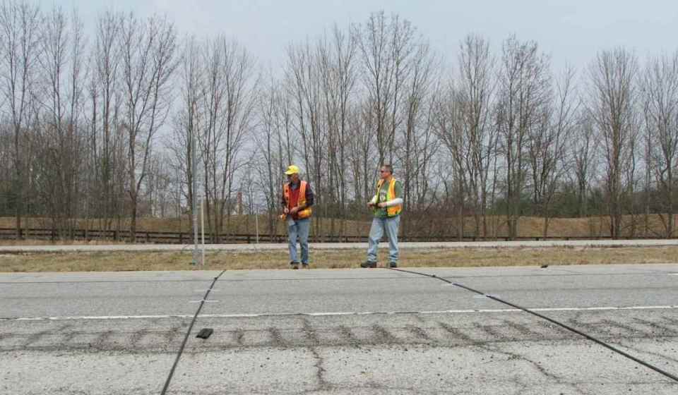
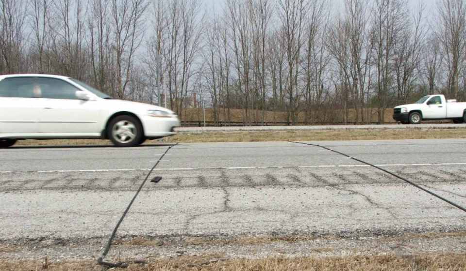
Project Description: This project was an interstate coverage counting assignment along I-469 in Allen County for INDOT’s Traffic Monitoring Section. This assignment involved collecting 48-hour machine counts at sixty-five (65) stations between I-69 and Dupont Road. In addition to completing the necessary fieldwork, United’s counting technicians processed the traffic count data and prepared reports (InForm, PRN Files, PRN Speed Files, and PDF Files) to satisfy current INDOT reporting requirements.
Project Description: An added travel lanes project along a portion of the SR 23 corridor in St. Joseph County was planned by INDOT. In order to assist with the design of this project, traffic projections were requested at 15 intersections for the years 2015, 2012, 2030, and 2032. At these intersections, all inbound legs, including turning movements and outbound legs were considered. The growth rates generated were used to project traffic data from 2008 to 2010, 2012, 2030, and 2032. The traffic data was expressed in terms of average annual daily traffic (AADT), AM and PM design hour volumes (DHV), DHV as a percent of AADT, and the percentage of commercial vehicles for both AADT and DHV.