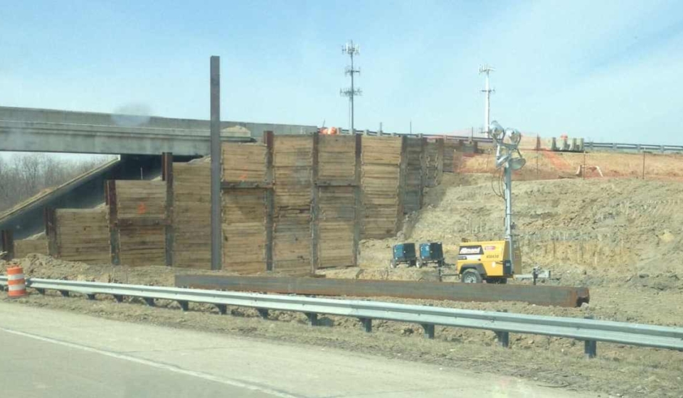
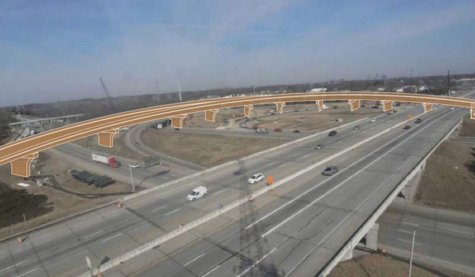
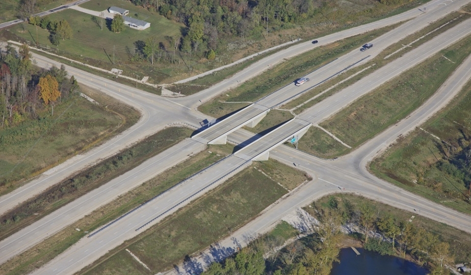
Project Description: This project included a new westbound I-465 to southbound I-65 fly-over ramp, added travel lanes on I-65 and I-465, ramp and median reconstruction, lighting, signing, retaining walls, and noise walls. The new bridge carrying westbound I-465 to southbound I-65 included 11 spans of pre-stressed concrete I-beams and is approximately 1,400-feet long. The entire design was completed on a fast track, 15-month schedule with United Consulting teaming with American Structurepoint to deliver this successful project for INDOT.
Approximate Project Cost: $40,000,000
This video shows the project from start to finish.
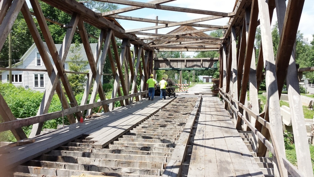
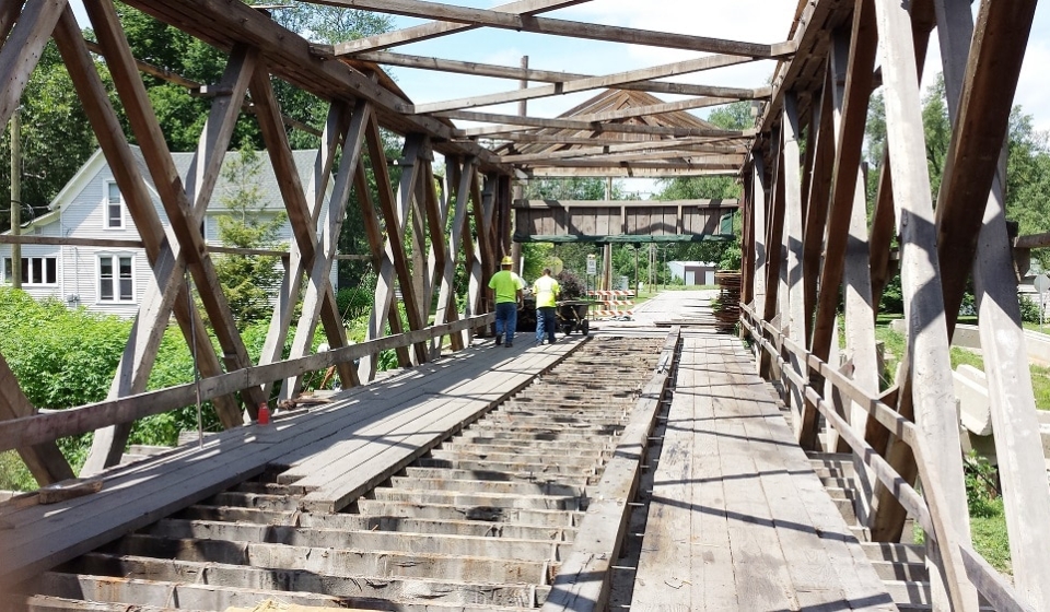
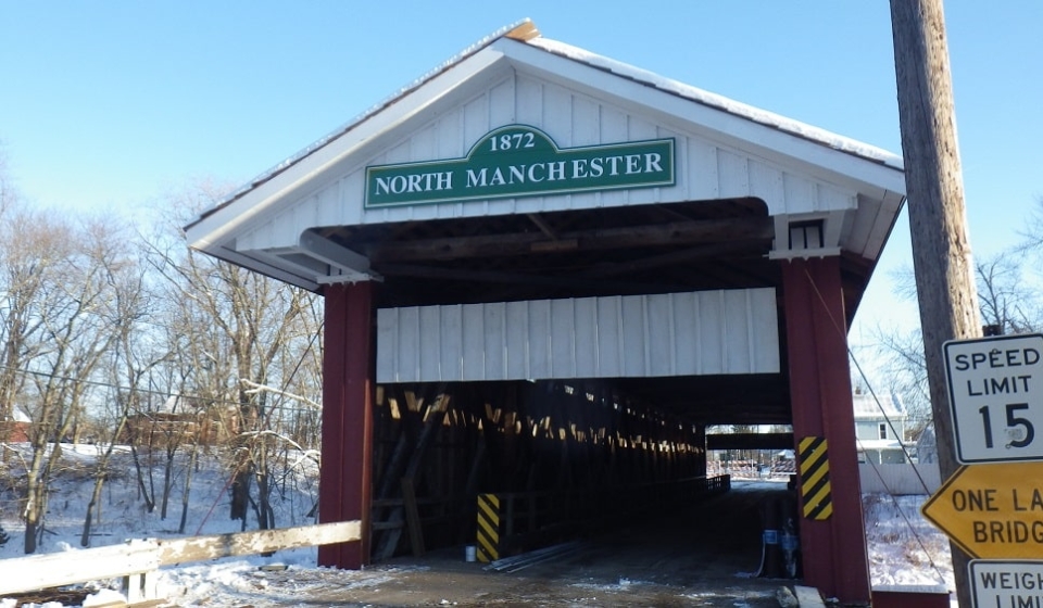
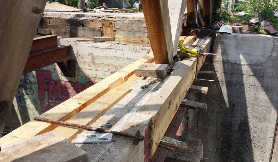
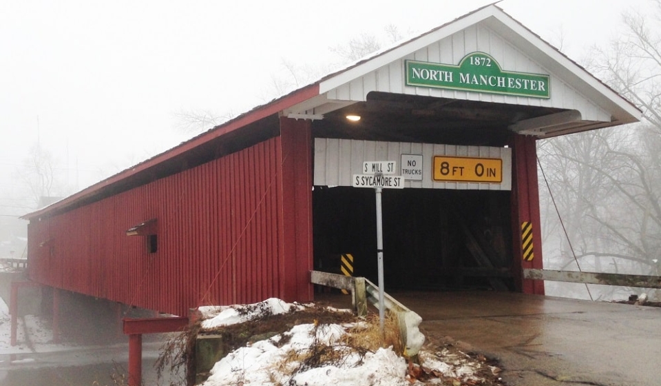
Project Description: Rehabilitation of the existing historic timber covered bridge in North Manchester, Indiana. The construction involved temporarily supporting the bridge while members of the timber trusses were removed and replaced or repaired. The existing members had to be inspected to determine if they could be reused or if they needed to be replaced. Replaced members had to closely match the original look of the timber bridge for historic purposes. A new timber shake roof was placed, the siding repaired and repainted, and the bridge was re-leveled to its original appearance. At completion, the bridge reopened to both pedestrian and vehicular traffic.
Steve Olsen of North Manchester Real Time Photography documented the bridge’s rehabilitation in the following video.
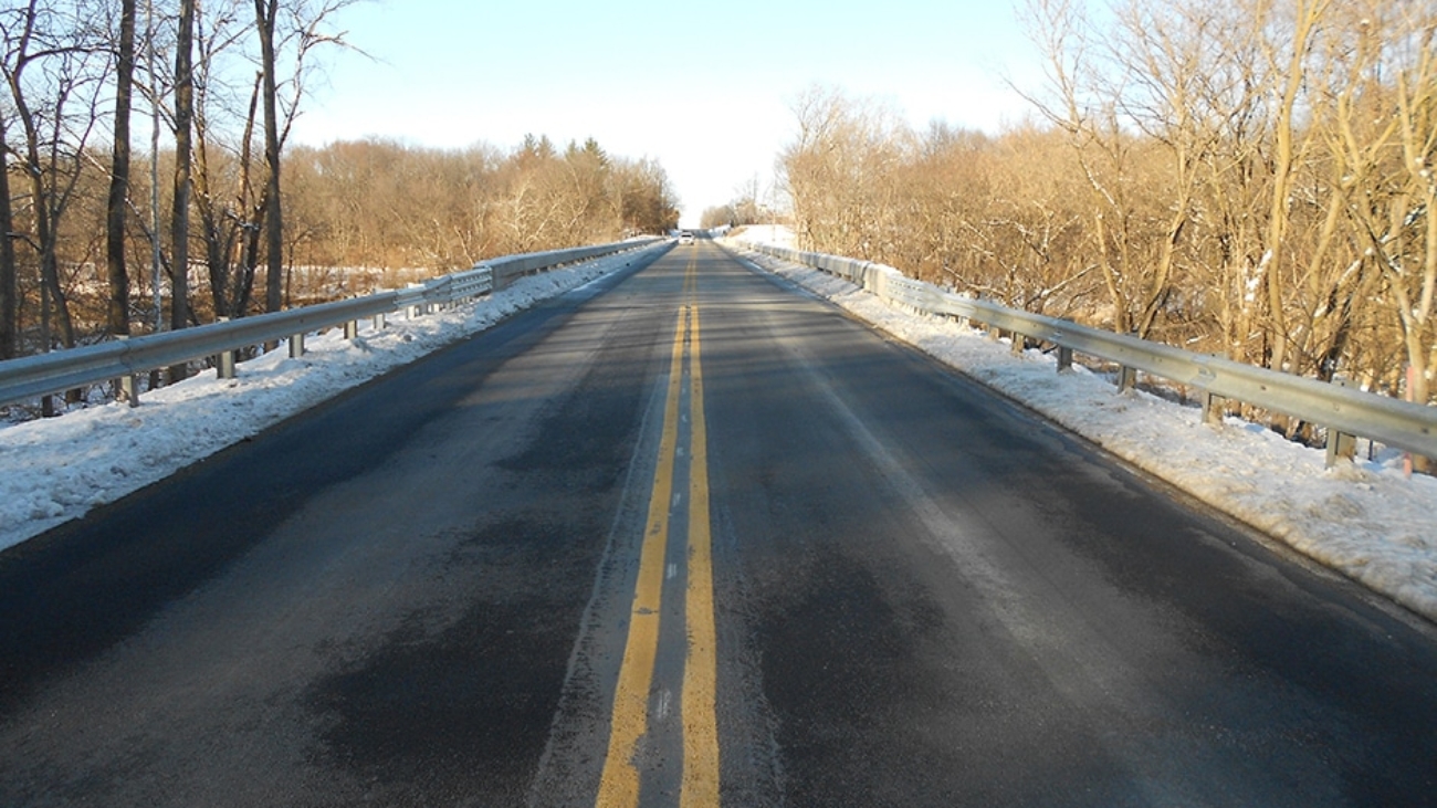
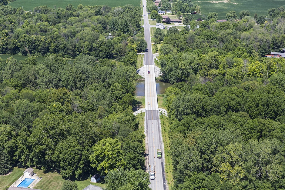
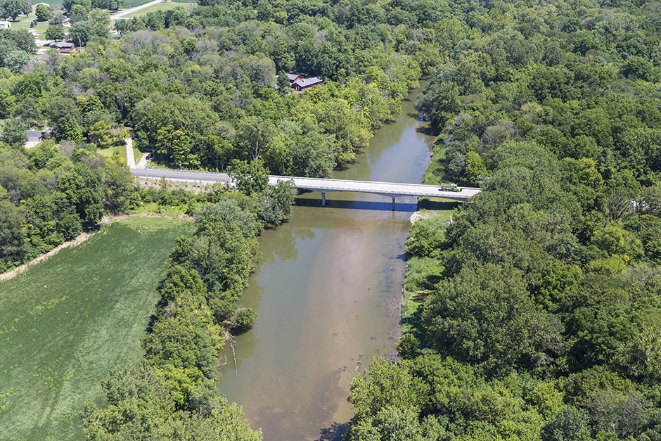
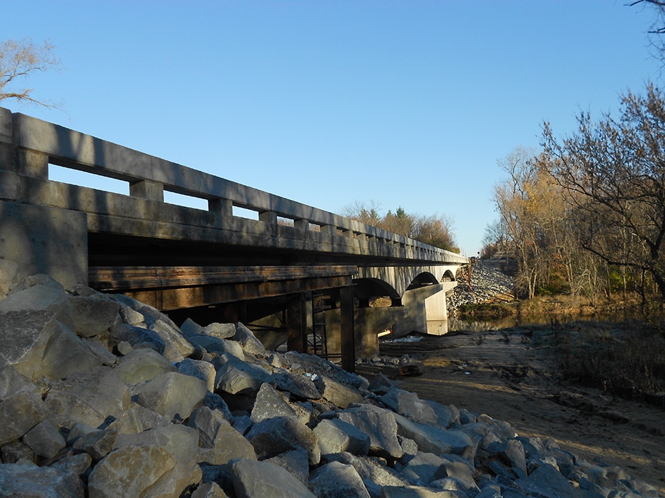
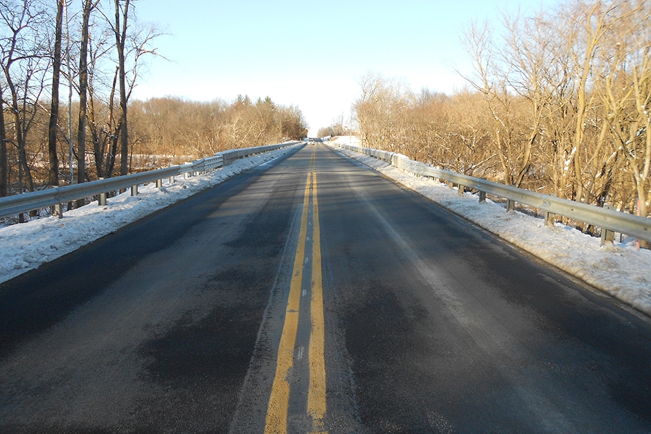
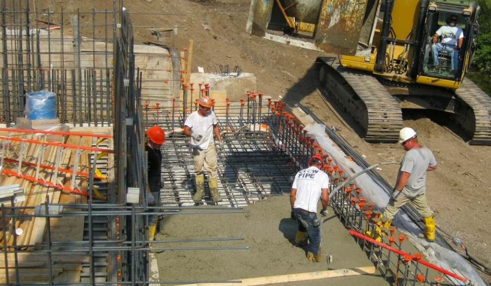
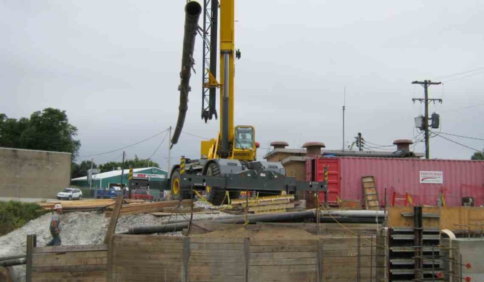
Project Description: Madison County Bridge No. 123 carries CR 600 West over the White River in Madison County. The structure is a four-span, continuous variable depth concrete girder with simple span concrete end-spans. The rehabilitation project included a complete deck replacement and reconstruction of the end-spans with prestressed concrete I-beams making them continuous with the existing historic concrete girders.
United developed a design and construction method for this structure that allowed for the deck replacement without any temporary supports for the historic girders. The negative moment reinforcement in the deck was maintained over the girders and the new deck constructed above this reinforcement using a staged pour sequence to reduce construction loading. The design also eliminated two expansion joints by making the approach spans continuous with the main span. This eliminated on-going maintenance concerns for the County and significantly extended the useful service life of this structure. These unique design concepts saved the county in both construction cost and schedule.
Approximate Construction Cost: $1,200,000
Breadth of Services Provided: Design Survey, Roadway Design, Bridge Design, Scour Analysis, Right-of-Way Acquisition, and Environmental Coordination, and Report Preparation
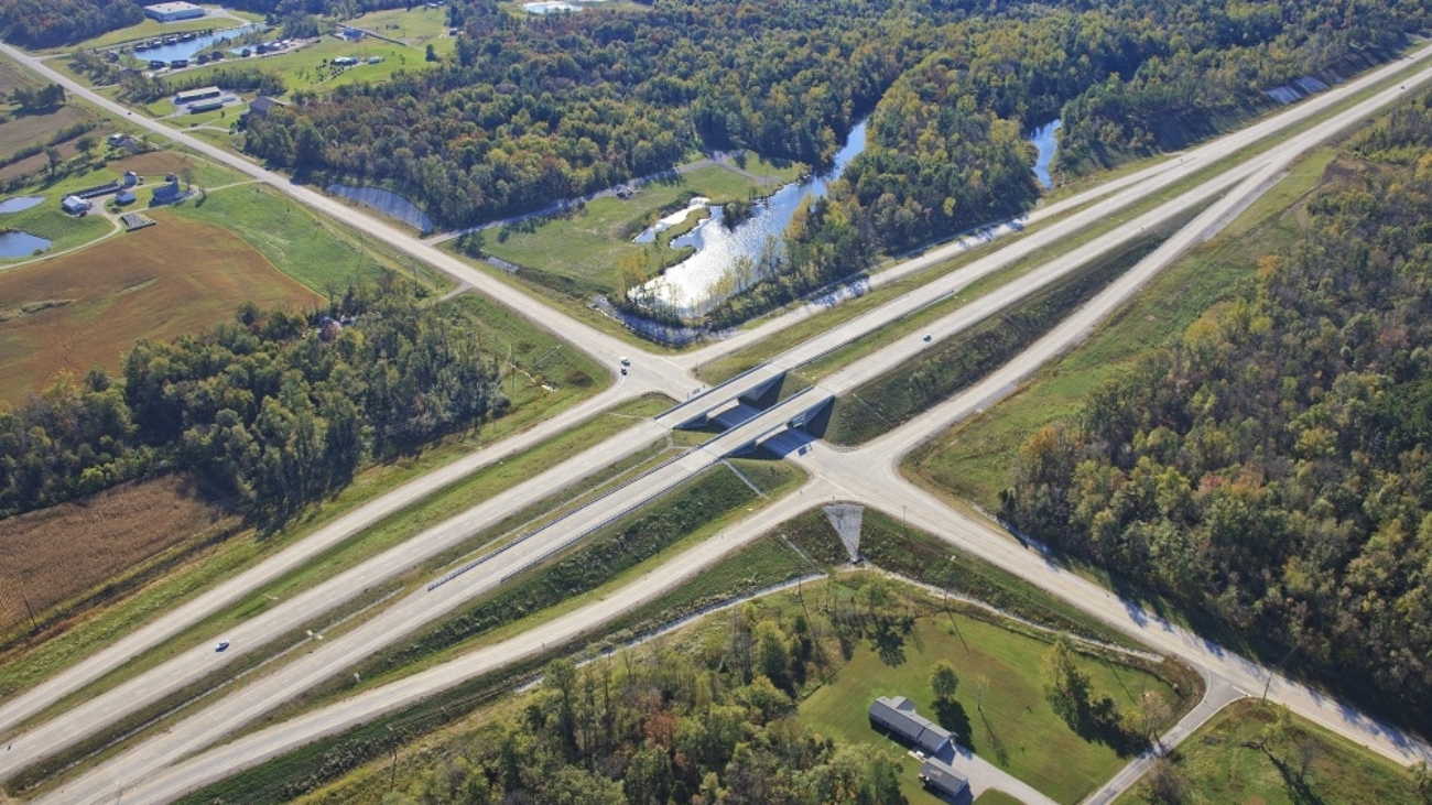
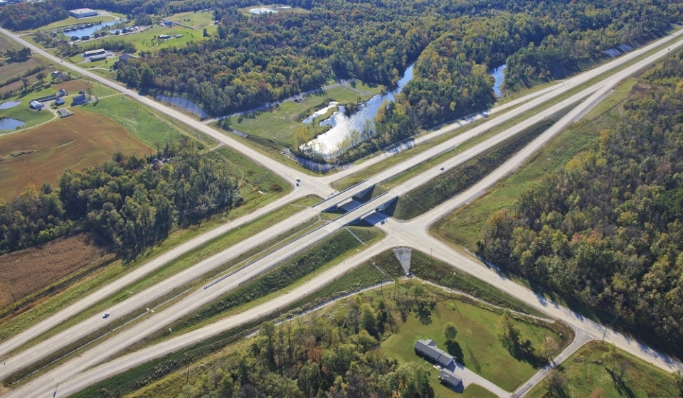
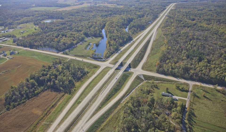
Project Description: US 231 Phase III Project in Spencer County is comprised of new terrain freeway totaling 4.5 miles of four-lane divided roadway with a grass median and two bridges in Spencer County. The project includes a railroad grade separation and a diamond interchange at SR 162. The project traverses densely wooded new terrain with large elevation changes and strip pits from past mining activities. Four local roads were relocated to maintain the limited access feature of the new US 231 freeway.
The project required extensive coordination with the INDOT Office of Geotechnical Engineering due to possible mine subsidence, ponds, and the types of soil identified in the soil boring including coal, shale, and sandstone. The project bisects three local service roads, a railroad, and State Road 162. Coordination with the local agencies, Hoosier Railroad identified solutions to minimize the new alignments impacts on the community.
The location control route survey and topographic survey included full ground survey on a terrain that included over 100 feet of elevation changes, ponds, and strip mines. The new alignment traversed land with elevation changes of more than 50 feet and was previously mined. Mining operations created unique geotechnical challenges which were coordinated as the project encountered mine spoils and created ponds.
Approximate Project Cost: $25,500,000
Breadth of Services Provided: Topographic Survey, Regulatory Permit Applications, Roadway Design, Bridge Design, Complex Sign Design, and Utility Coordination
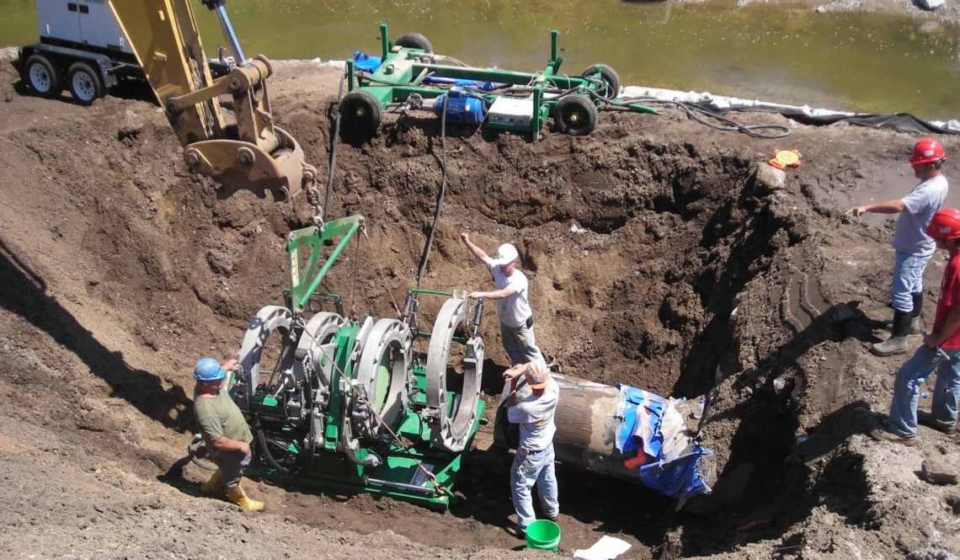
Project Description: The City’s existing lift station that conveyed wastewater for a large portion of the north side of Terre Haute was beyond its design life and in need of replacement.
United Consulting designed the new facility with a design capacity of 20 million gallons per day including a new, cast-in-place concrete structure, masonry building, submersible pumps with VFD controls, dual mechanical screen equipment, and other necessary improvements.
Approximate Project Cost: $5,500,000
Breadth of Services Provided: Survey, Land Acquisition, Design Engineering, Permitting, and Construction Administration
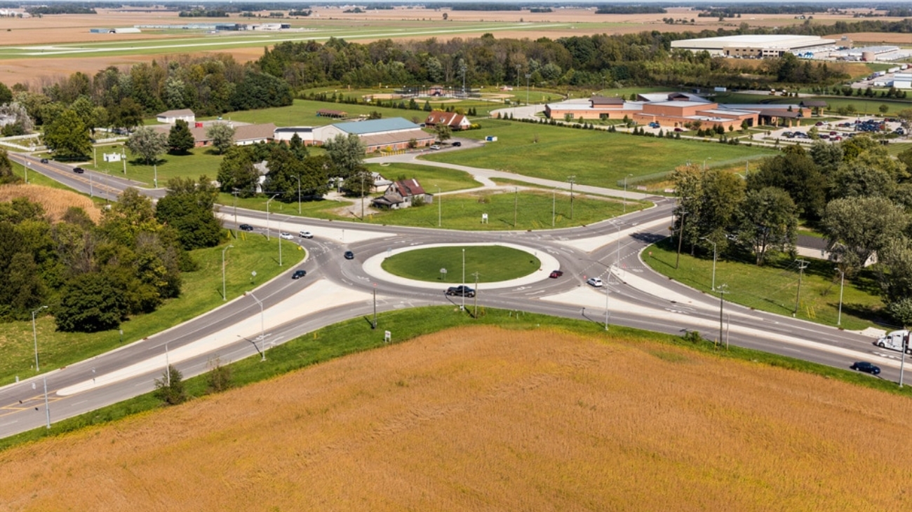
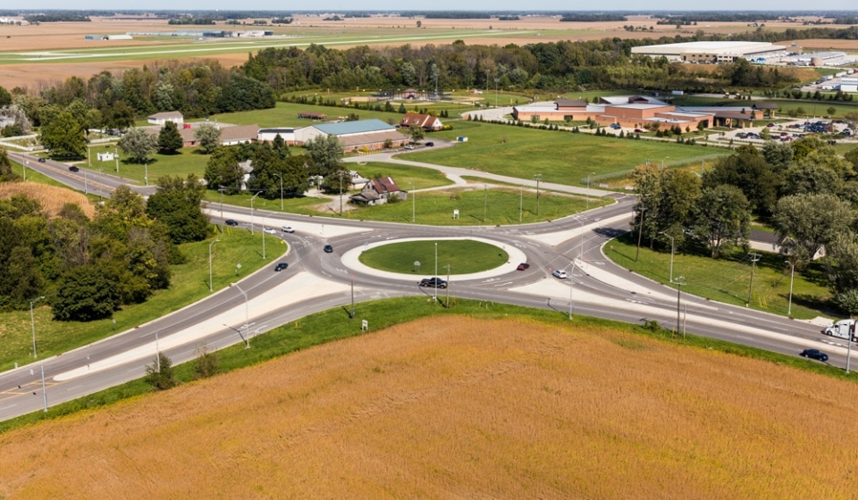
Project Description: The intersection of Mount Comfort Road (CR 600 W) and CR 300 N is the culmination point for traffic from several industrial and commercial property developments heading south to I-70. A traffic simulation model was generated utilizing existing traffic counts as well as traffic studies for several industrial and commercial developments. Based on the results of the model, it was determined that dual left turns would be required for the westbound to southbound movement and a right lane by-pass would be added for the northbound to eastbound movement.
A key principle, when driving through a roundabout, is the idea that a driver never has to change lanes. This was achieved on the CR 600 W and CR 300 N roundabout through the use of a spiral. A spiral, moves traffic from the inside lane to the outside lane without the need for the driver to change lanes.
Finally, the most challenging part of any multi-lane roundabout design is controlling the fast path speeds. The easiest way to control the entering speed is to provide deflection. The entering speed has to be balanced with the circulating speed especially when heavy truck volumes are anticipated, which is the case for this intersection. To help provide deflection and ultimately reduce the fast path speeds, without significantly reducing the entrance radii, horizontal curves were introduced into the alignments approximately 300 feet prior to the roundabout in all directions.
Approximate Project Cost: $2,700,000
Breadth of Services Provided: Design Services, Right-of-Way Engineering, Construction Inspection
Project Description: The City of Sullivan Five Year Parks & Recreation Master Plan includes provisions for the following: Definition of the Planning Area, Brief History of Parks and Recreation Board/Agency, Goals & Objectives, Marketing Strategies, Supply Analysis, Natural Features & Landscape, Man-Made, Historical, & Cultural Features, Social & Demographic Factors, Economic Factors, Barrier Free Programming and Universal Design. Public Participation, Demand Analysis, Needs Analysis, Priorities, Action Schedule/ Implementation Plan, General Public Meeting on Draft Master Plan, Evaluation Strategy, Park Board Resolution Adopting Plan, and Section 504 Assurance of Compliance.
Project Description: The Town of Carlisle Five Year Parks & Recreation Master Plan includes provisions for the following: Definition of the Planning Area, Brief History of Parks and Recreation Board/Agency, Goals & Objectives, Marketing Strategies, Supply Analysis, Natural Features & Landscape, Man-Made, Historical, & Cultural Features, Social & Demographic Factors, Economic Factors, Barrier Free Programming and Universal Design, Public Participation, Demand Analysis, Needs Analysis, Priorities, Action Schedule/Implementation Plan, General Public Meeting on Draft Master Plan, Evaluation Strategy, Park Board Resolution Adopting Plan, and Section 504 Assurance of Compliance.
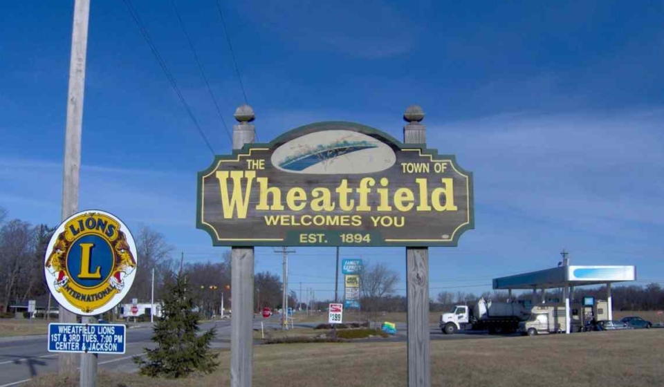
Project Description: The Comprehensive Plan included a detailed inventory of existing conditions, statements concerning town-wide goals and objectives, and an analysis of projected future needs and recommendations to meet or exceed those needs. The Comprehensive Plan is an environmental, physical, and social evaluation tool which will provide the Town of Wheatfield with guidance necessary to achieve pre-determined future goals and objectives. The Comprehensive Plan covers broad topics such as land use, environmental preservation (farmland preservation), housing needs, transportation and other public facilities, economic development, and town facilities (schools, parks, libraries, etc.).
Project Description: With the goal of reducing congestion and improving safety and mobility along the route, United completed preliminary and final design on 15 bridges for the upgrade and realignment of US 31 from US 30 in Plymouth to the US 20 bypass in South Bend. These projects included multiple bridge types from single-span prestressed girders to a three-span steel plate girder structure with integral post-tensioned straddle bent pier caps at a single-point interchange.
United also completed the “Fast Track” rural five-mile Grading Contract and the more complex urban design in the northern two miles. The six different urban Contracts included pavement reconstruction, retaining walls, local road improvements, bridge replacements, signing, signal design, and a single-point urban interchange.
This project is part of the larger Major Moves initiative to upgrade the route to freeway standards from Indianapolis to South Bend.