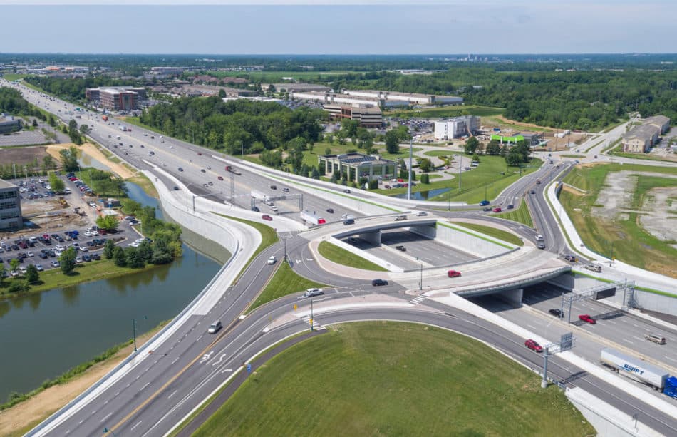
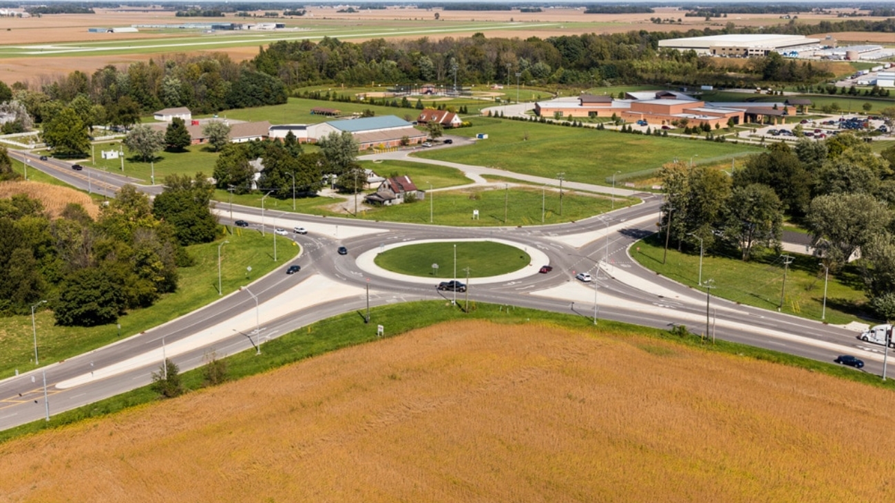
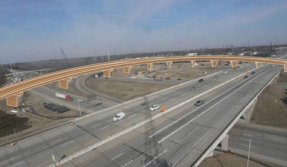
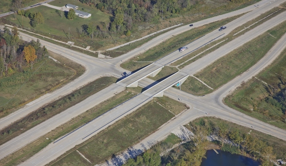
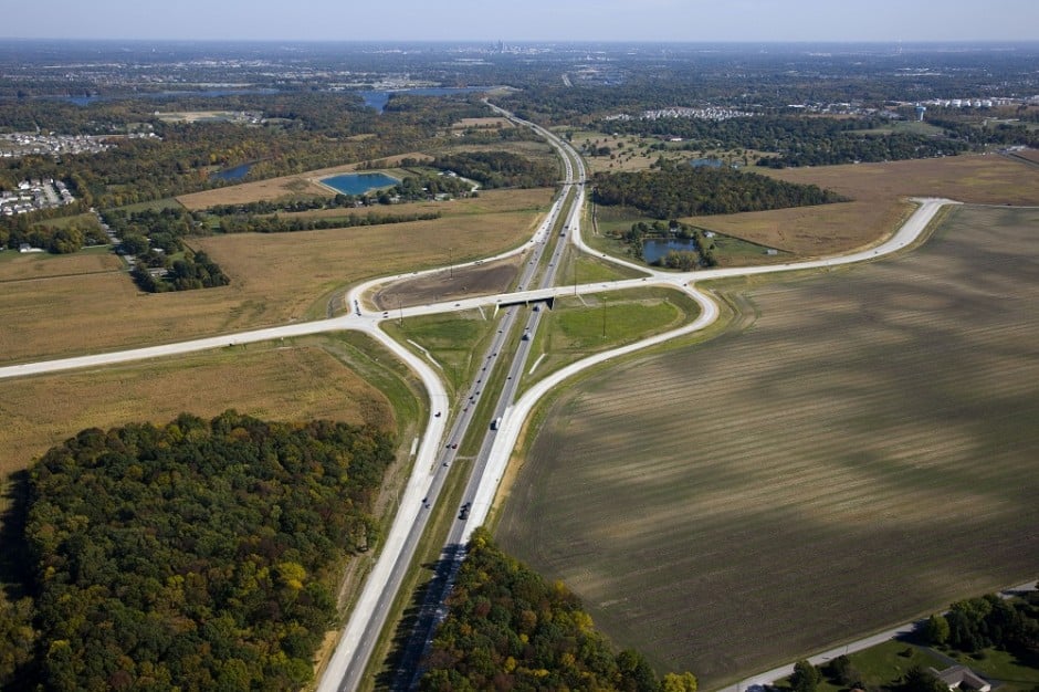
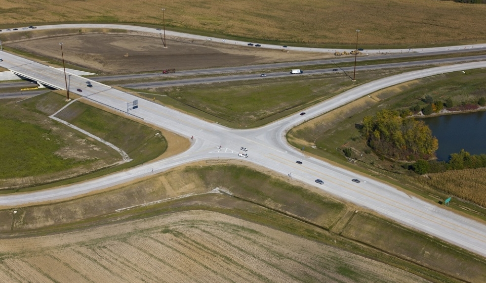
Project Description: This multi-agency project with INDOT, City of Fishers, and Hamilton County provided a new interchange on I-69 at 106th street that has served as a catalyst for economic development while reducing congestion along the busy I-69 corridor. The purpose of the project was to create a new access point to I-69 and improve the traffic operations of the adjacent interchanges at 96th Street and 116th Street. United was selected and worked through the evaluation of the different interchange alternatives. The chosen alternative for the interchange featured a two-lane, oval-shaped roundabout on 106th Street over I-69 including ramps to and from both directions of the interstate. Two separate two-lane bridges carry one direction of traffic. The westbound traffic bridge on the north side of 106th Street was also designed to accommodate pedestrians.
Approximate Construction Cost: $21,000,000
Breadth of Services Provided: Traffic Counting, Traffic Analysis, Road Design, Bridge Design, Hydraulics, Pavement Design, Utility Coordination, Regulatory Permits, Right-of-Way Engineering, and Land Acquisition
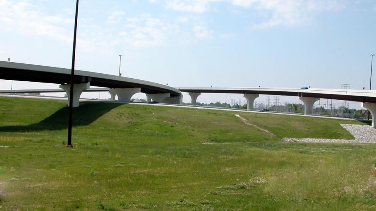
Project Description: This project included a new westbound I-465 to southbound I-65 fly-over ramp, added travel lanes on I-65 and I-465, ramp and median reconstruction, lighting, signing, retaining walls, and noise walls. The new bridge carrying westbound I-465 to southbound I-65 included 11 spans of pre-stressed concrete I-beams and is approximately 1,400-feet long. The entire design was completed on a fast track, 15-month schedule with United Consulting teaming with American Structurepoint to deliver this successful project for INDOT.
Approximate Project Cost: $40,000,000
This video shows the project from start to finish.
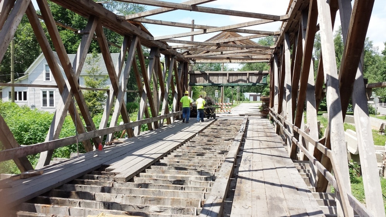
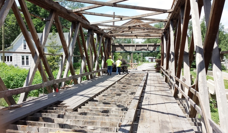
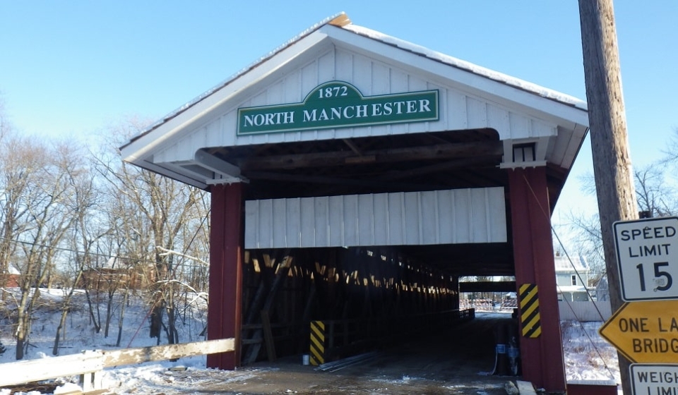
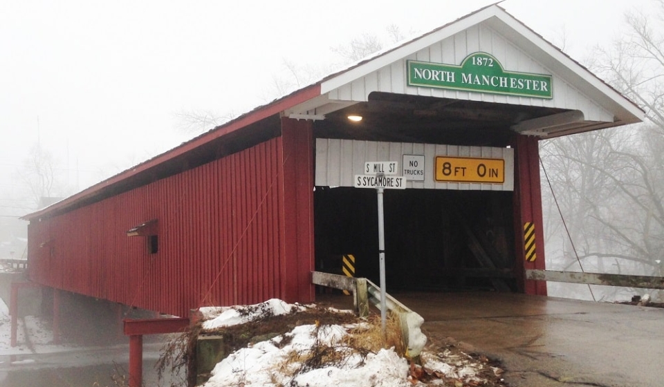
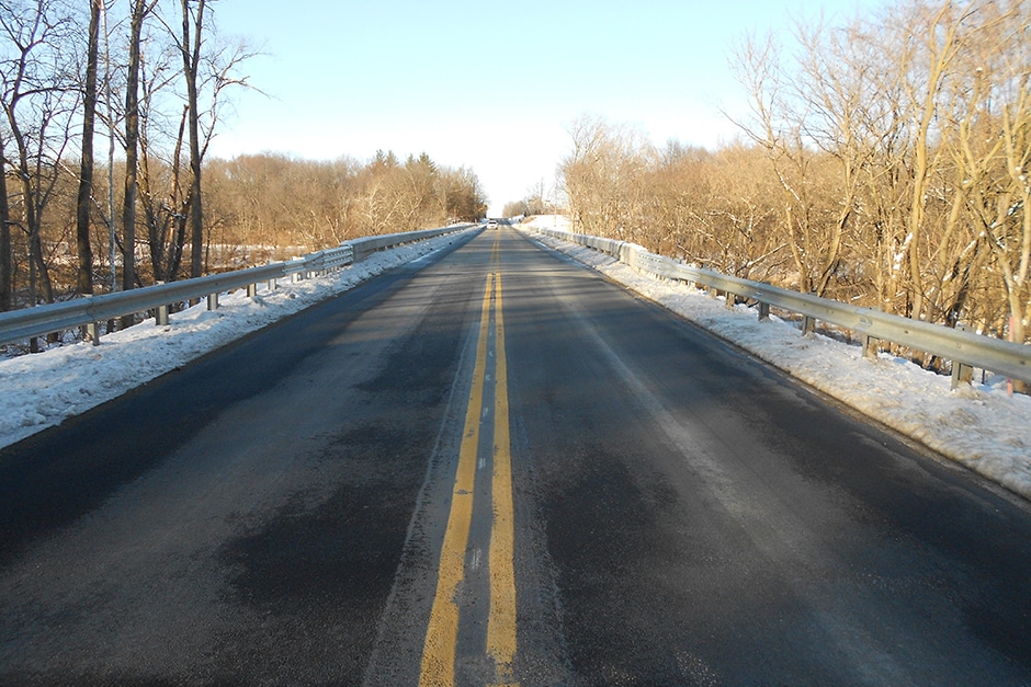
Project Description: Rehabilitation of the existing historic timber covered bridge in North Manchester, Indiana. The construction involved temporarily supporting the bridge while members of the timber trusses were removed and replaced or repaired. The existing members had to be inspected to determine if they could be reused or if they needed to be replaced. Replaced members had to closely match the original look of the timber bridge for historic purposes. A new timber shake roof was placed, the siding repaired and repainted, and the bridge was re-leveled to its original appearance. At completion, the bridge reopened to both pedestrian and vehicular traffic.
Steve Olsen of North Manchester Real Time Photography documented the bridge’s rehabilitation in the following video.
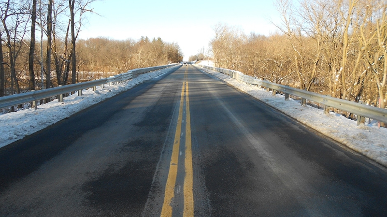
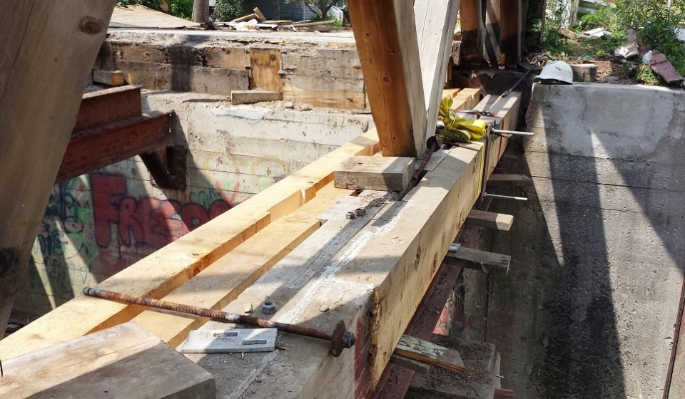
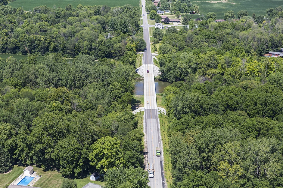
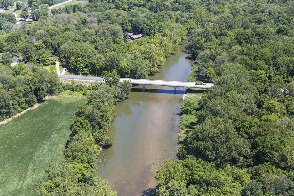
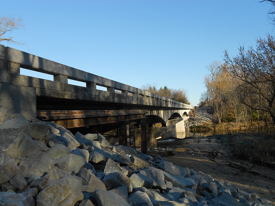
Project Description: Madison County Bridge No. 123 carries CR 600 West over the White River in Madison County. The structure is a four-span, continuous variable depth concrete girder with simple span concrete end-spans. The rehabilitation project included a complete deck replacement and reconstruction of the end-spans with prestressed concrete I-beams making them continuous with the existing historic concrete girders.
United developed a design and construction method for this structure that allowed for the deck replacement without any temporary supports for the historic girders. The negative moment reinforcement in the deck was maintained over the girders and the new deck constructed above this reinforcement using a staged pour sequence to reduce construction loading. The design also eliminated two expansion joints by making the approach spans continuous with the main span. This eliminated on-going maintenance concerns for the County and significantly extended the useful service life of this structure. These unique design concepts saved the county in both construction cost and schedule.
Approximate Construction Cost: $1,200,000
Breadth of Services Provided: Design Survey, Roadway Design, Bridge Design, Scour Analysis, Right-of-Way Acquisition, and Environmental Coordination, and Report Preparation
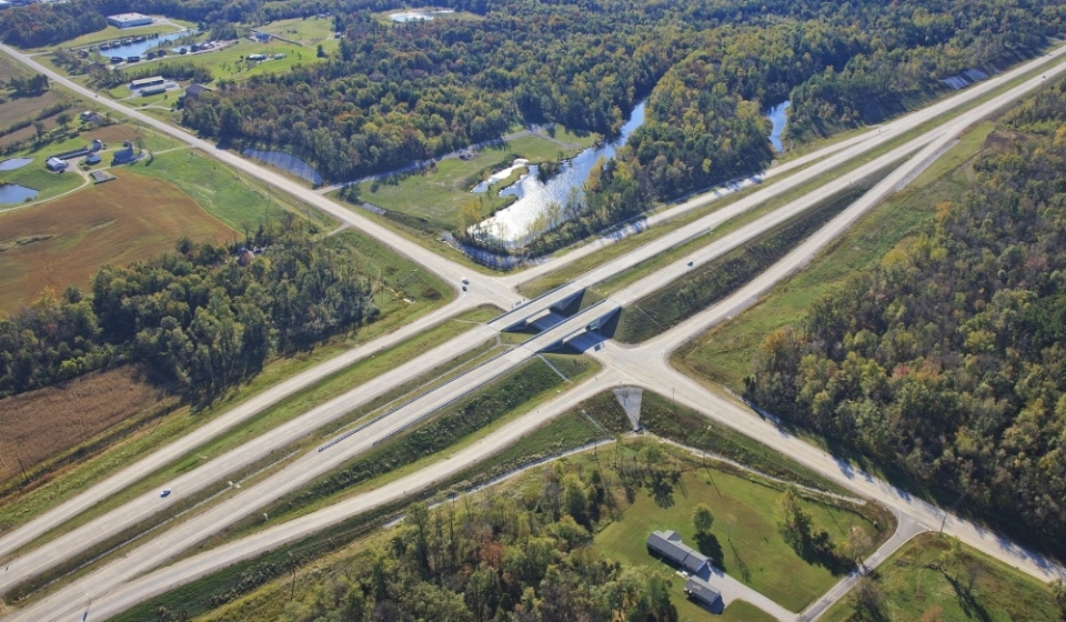
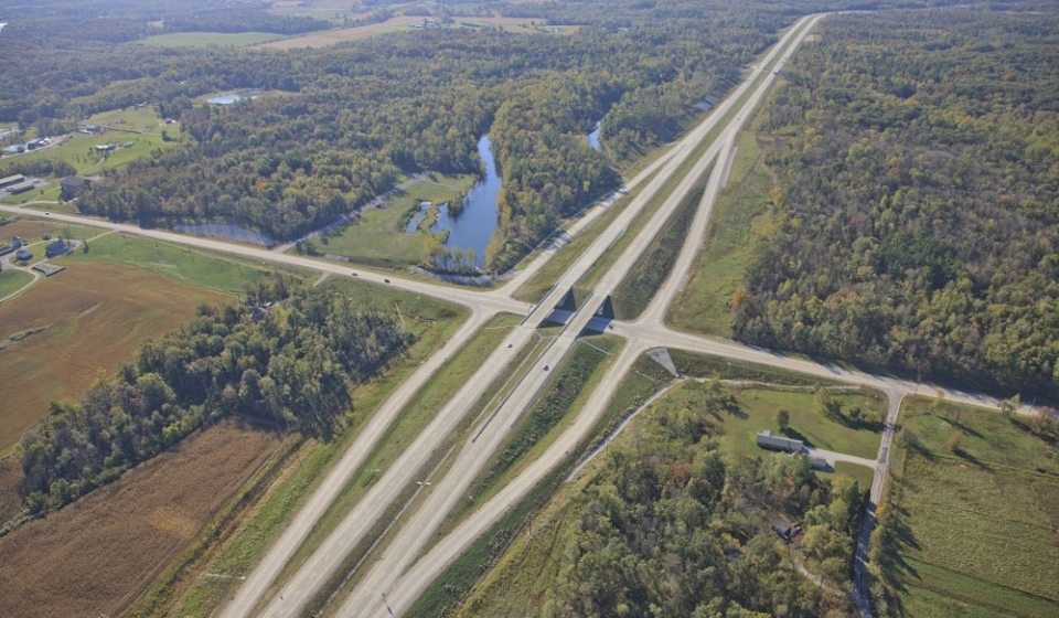
Project Description: US 231 Phase III Project in Spencer County is comprised of new terrain freeway totaling 4.5 miles of four-lane divided roadway with a grass median and two bridges in Spencer County. The project includes a railroad grade separation and a diamond interchange at SR 162. The project traverses densely wooded new terrain with large elevation changes and strip pits from past mining activities. Four local roads were relocated to maintain the limited access feature of the new US 231 freeway.
The project required extensive coordination with the INDOT Office of Geotechnical Engineering due to possible mine subsidence, ponds, and the types of soil identified in the soil boring including coal, shale, and sandstone. The project bisects three local service roads, a railroad, and State Road 162. Coordination with the local agencies, Hoosier Railroad identified solutions to minimize the new alignments impacts on the community.
The location control route survey and topographic survey included full ground survey on a terrain that included over 100 feet of elevation changes, ponds, and strip mines. The new alignment traversed land with elevation changes of more than 50 feet and was previously mined. Mining operations created unique geotechnical challenges which were coordinated as the project encountered mine spoils and created ponds.
Approximate Project Cost: $25,500,000
Breadth of Services Provided: Topographic Survey, Regulatory Permit Applications, Roadway Design, Bridge Design, Complex Sign Design, and Utility Coordination
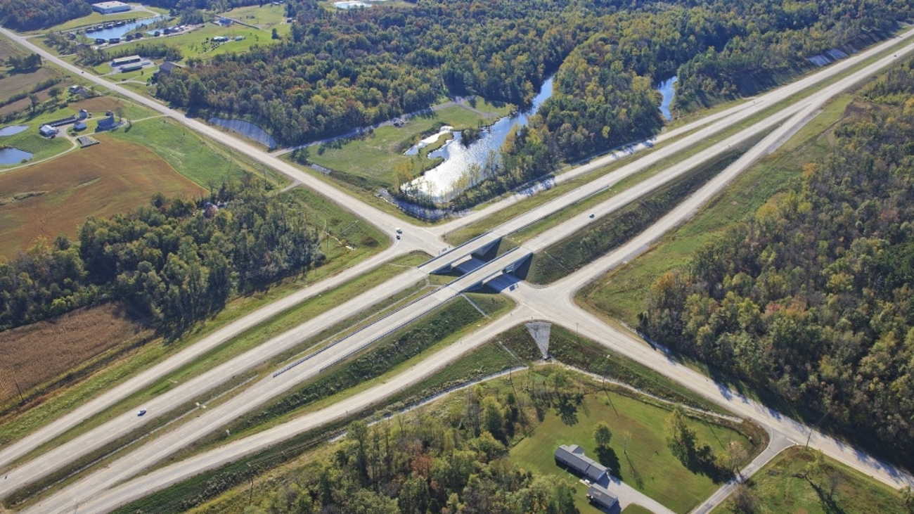
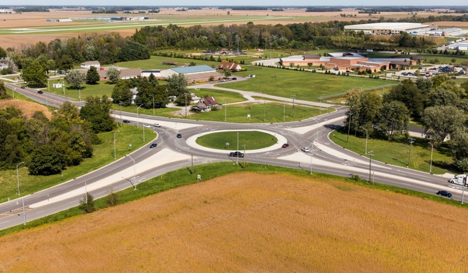
Project Description: The intersection of Mount Comfort Road (CR 600 W) and CR 300 N is the culmination point for traffic from several industrial and commercial property developments heading south to I-70. A traffic simulation model was generated utilizing existing traffic counts as well as traffic studies for several industrial and commercial developments. Based on the results of the model, it was determined that dual left turns would be required for the westbound to southbound movement and a right lane by-pass would be added for the northbound to eastbound movement.
A key principle, when driving through a roundabout, is the idea that a driver never has to change lanes. This was achieved on the CR 600 W and CR 300 N roundabout through the use of a spiral. A spiral, moves traffic from the inside lane to the outside lane without the need for the driver to change lanes.
Finally, the most challenging part of any multi-lane roundabout design is controlling the fast path speeds. The easiest way to control the entering speed is to provide deflection. The entering speed has to be balanced with the circulating speed especially when heavy truck volumes are anticipated, which is the case for this intersection. To help provide deflection and ultimately reduce the fast path speeds, without significantly reducing the entrance radii, horizontal curves were introduced into the alignments approximately 300 feet prior to the roundabout in all directions.
Approximate Project Cost: $2,700,000
Breadth of Services Provided: Design Services, Right-of-Way Engineering, Construction Inspection
Project Description: With the goal of reducing congestion and improving safety and mobility along the route, United completed preliminary and final design on 15 bridges for the upgrade and realignment of US 31 from US 30 in Plymouth to the US 20 bypass in South Bend. These projects included multiple bridge types from single-span prestressed girders to a three-span steel plate girder structure with integral post-tensioned straddle bent pier caps at a single-point interchange.
United also completed the “Fast Track” rural five-mile Grading Contract and the more complex urban design in the northern two miles. The six different urban Contracts included pavement reconstruction, retaining walls, local road improvements, bridge replacements, signing, signal design, and a single-point urban interchange.
This project is part of the larger Major Moves initiative to upgrade the route to freeway standards from Indianapolis to South Bend.
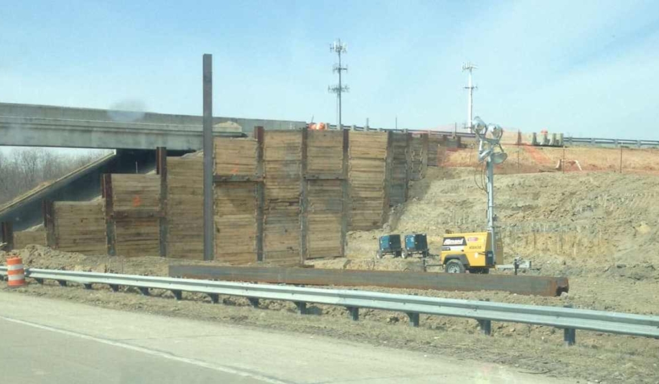
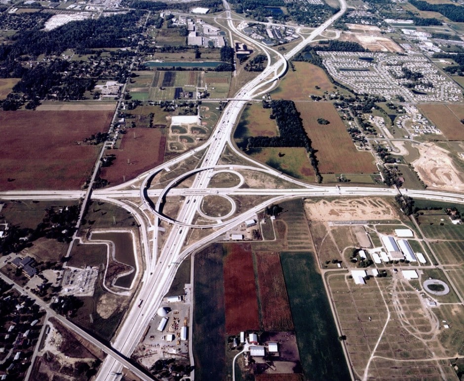
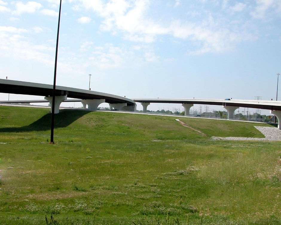
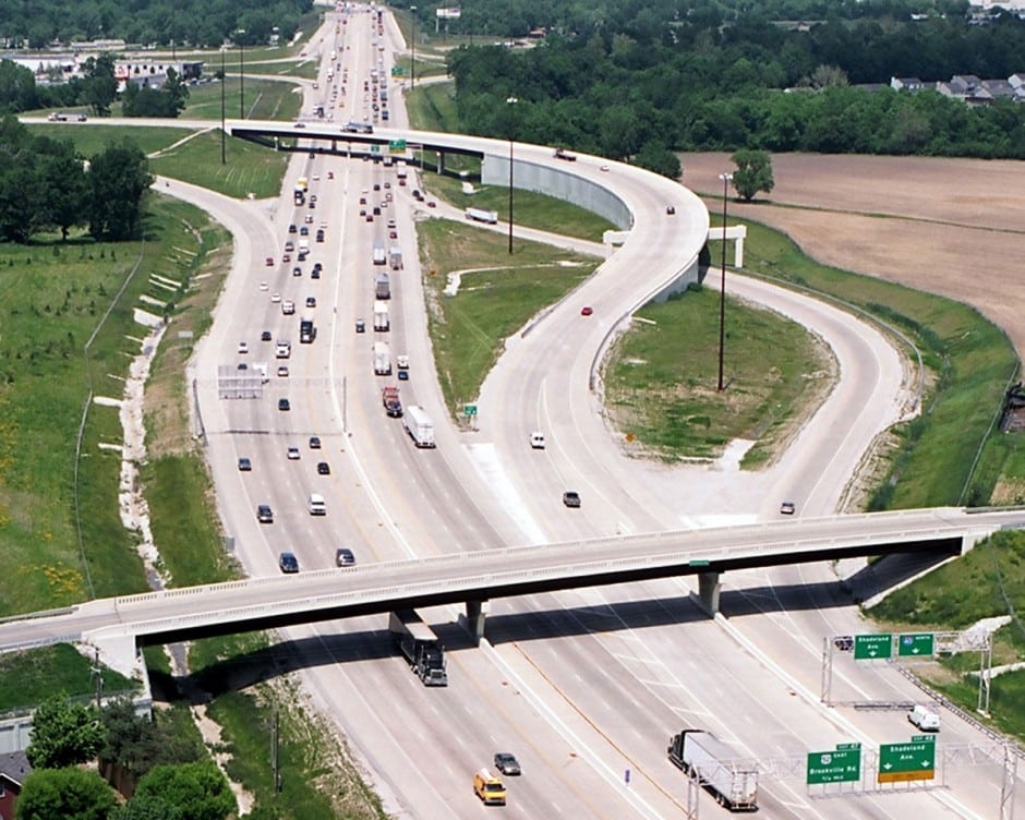
Project Description: The project included the complete reconstruction of the system to system interchange at I-465 and I-74. It also reconstructed the interchange access from I-465 to Brookville Road and Shadeland Avenue. The interchange configuration involved extensive coordination with geotechnical to determine the most cost-effective solutions for the fly-over ramps. It was determined in that longer bridges were more economical than walls due to the existing soil conditions. Maintenance of Traffic was a major component of the design due to the urban environment. Additionally, detention and lift station designs were completed as part of the project to facilitate drainage.
Approximate Project Cost: $74,000,000
Breadth of Services Provided: Regulatory Permit Applications, Roadway Design, and Bridge Design
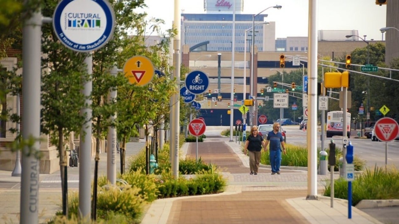
On November 15, 2012, the United Consulting/Rundell Ernstberger Asociates, LLC team received the highest honor at the 35th annual Monumental Affairs Awards Ceremony. The team was awarded the Monumental Award for the Indianapolis Cultural Trail: A Legacy of Gene & Marilyn Glick. The Monumental Award is the highest honor presented at this annual event sponsored by the Indianapolis Chamber of Commerce. United Consulting also received an Honor Award for the Indianapolis Cultural Trail project in the Engineering category.
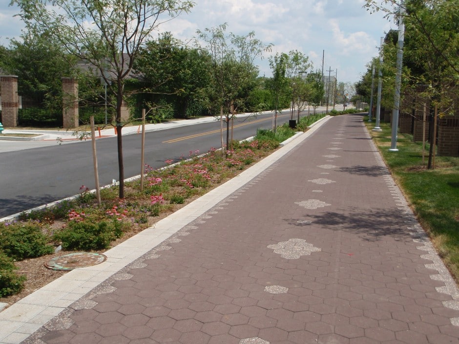
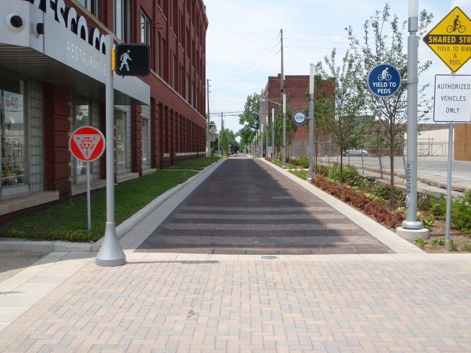
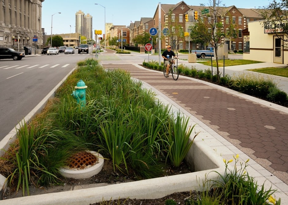
Project Description: An urban bike and pedestrian path connecting together five downtown cultural districts and the entire greenways system.
This project constructed eight miles of new shared-use paths and sidewalks in and around downtown Indianapolis highlighting adjacent cultural districts, incorporating art into public spaces, and emphasizing green and context sensitive design. Every intersection required careful consideration of the interactions between vehicular, pedestrian, and bicycle traffic.
The project was a collaborative effort by the City of Indianapolis Department of Public Works and Central Indiana Community Foundation.
United’s responsibilities included the design of detailed signing and marking plans, grading plans that included over 13,000 individual spot elevations and drainage design that included heavy usage of storm water planters to help reduce runoff into the City’s combined sewer system.
Approximate Project Cost: $40,000,000
Breadth of Services Provided: Transportation Engineering and Utility Coordination
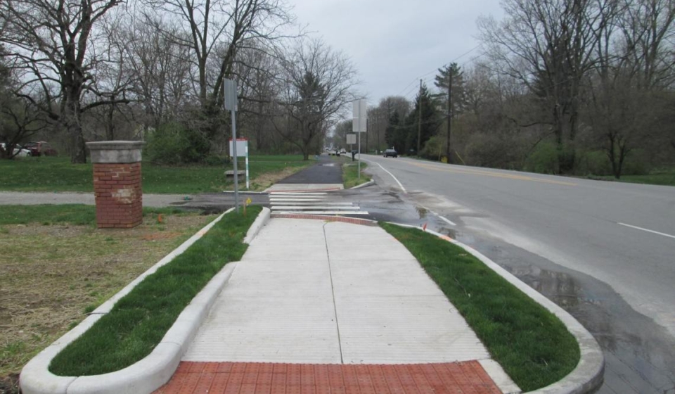
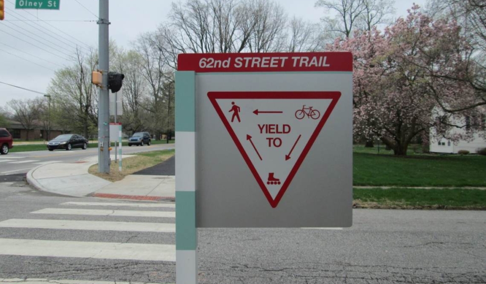
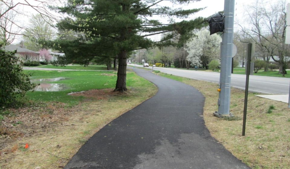
Project Description: This project provides much needed pedestrian and bicycle connectivity between Keystone Avenue and Allisonville Road. Prior to the construction of the trail, bicycle and pedestrian traffic had to use the side of the roadway. This new trail provides an easy access for users to reach other trails in the area as well as to reach nearby commerce.
This project runs through the front yard easements of more than 50 houses and provides a safe location for commuters and recreational use by the installation of a 10 foot multi-use path. This project was designed to fit within the existing right-of-way and to accommodate a meandering trail alignment to blend with the neighborhood.
The pathway extends along the south side of 62nd Street. The total project length was 1.35 miles. The existing right turn lane on 62nd Street between Keystone Avenue and Rural Street was removed to allow space for the proposed multi-use path. A buffer varying in width from four feet to 22 feet was established between the roadway and the multi-use path. Additionally, ADA compliant curb ramps and cross walk striping were constructed at each of the major intersections.
From a recent Indianapolis Star article, one resident of the area stated “It’s opened up a whole new way of getting around. It’s the greatest thing.” The resident went on to say, “I was worried about strangers, but it seems like such an active, family environment. We love it.”
Approximate Construction Cost: $1,400,000
Breadth of Services Provided: Transportation Engineering
Shopping Basket
Cookie Consent
We use cookies to improve your experience on our site. By using our site, you consent to cookies.
Cookie Preferences
Manage your cookie preferences below:
Essential cookies enable basic functions and are necessary for the proper function of the website.
Name
Description
Duration
Cookie Preferences
This cookie is used to store the user's cookie consent preferences.