Project Description: The City of Sullivan Five Year Parks & Recreation Master Plan includes provisions for the following: Definition of the Planning Area, Brief History of Parks and Recreation Board/Agency, Goals & Objectives, Marketing Strategies, Supply Analysis, Natural Features & Landscape, Man-Made, Historical, & Cultural Features, Social & Demographic Factors, Economic Factors, Barrier Free Programming and Universal Design. Public Participation, Demand Analysis, Needs Analysis, Priorities, Action Schedule/ Implementation Plan, General Public Meeting on Draft Master Plan, Evaluation Strategy, Park Board Resolution Adopting Plan, and Section 504 Assurance of Compliance.
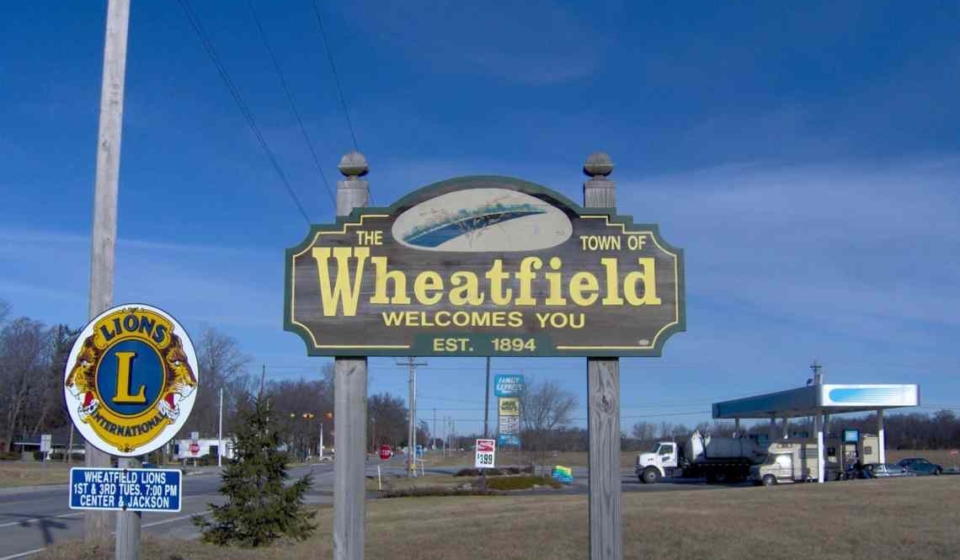
Project Description: The Comprehensive Plan included a detailed inventory of existing conditions, statements concerning town-wide goals and objectives, and an analysis of projected future needs and recommendations to meet or exceed those needs. The Comprehensive Plan is an environmental, physical, and social evaluation tool which will provide the Town of Wheatfield with guidance necessary to achieve pre-determined future goals and objectives. The Comprehensive Plan covers broad topics such as land use, environmental preservation (farmland preservation), housing needs, transportation and other public facilities, economic development, and town facilities (schools, parks, libraries, etc.).
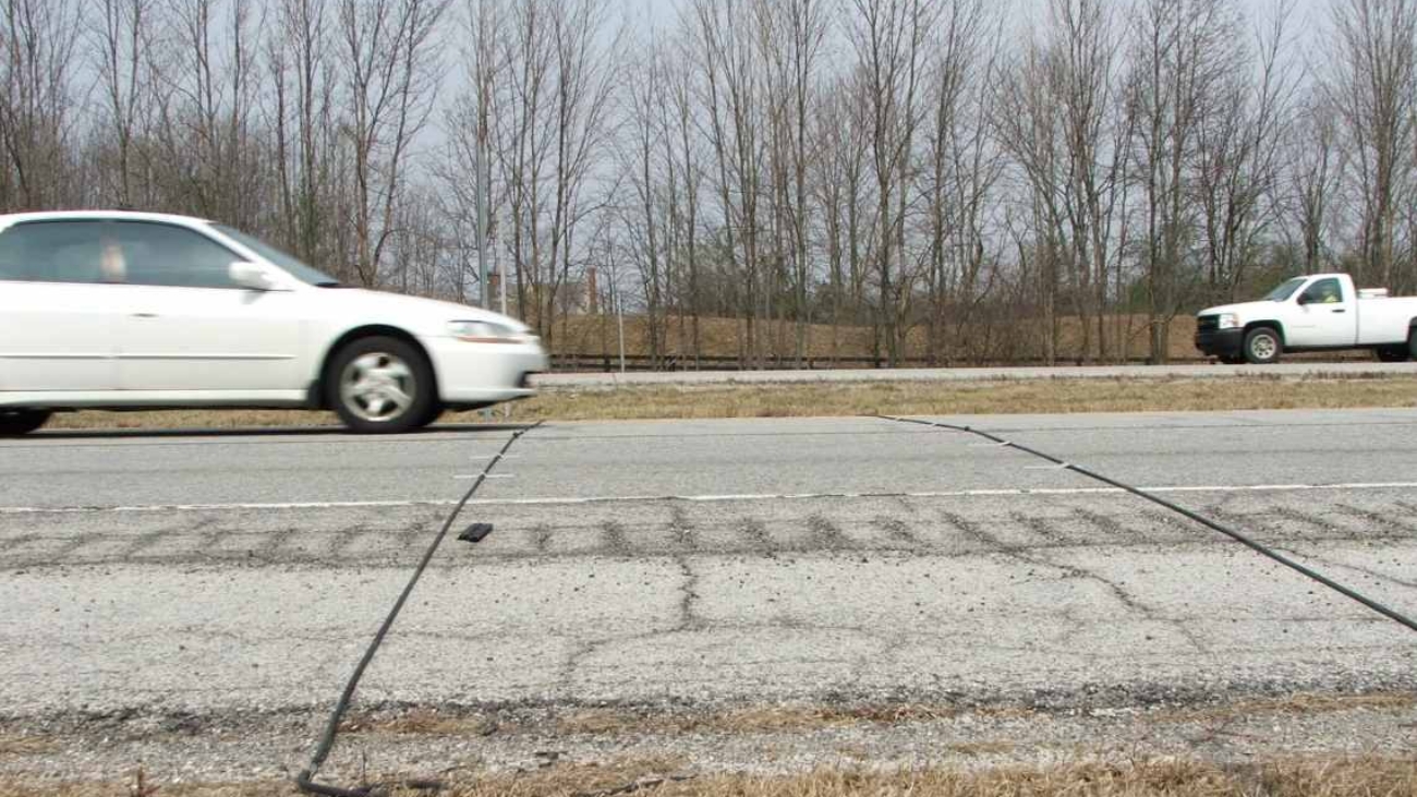
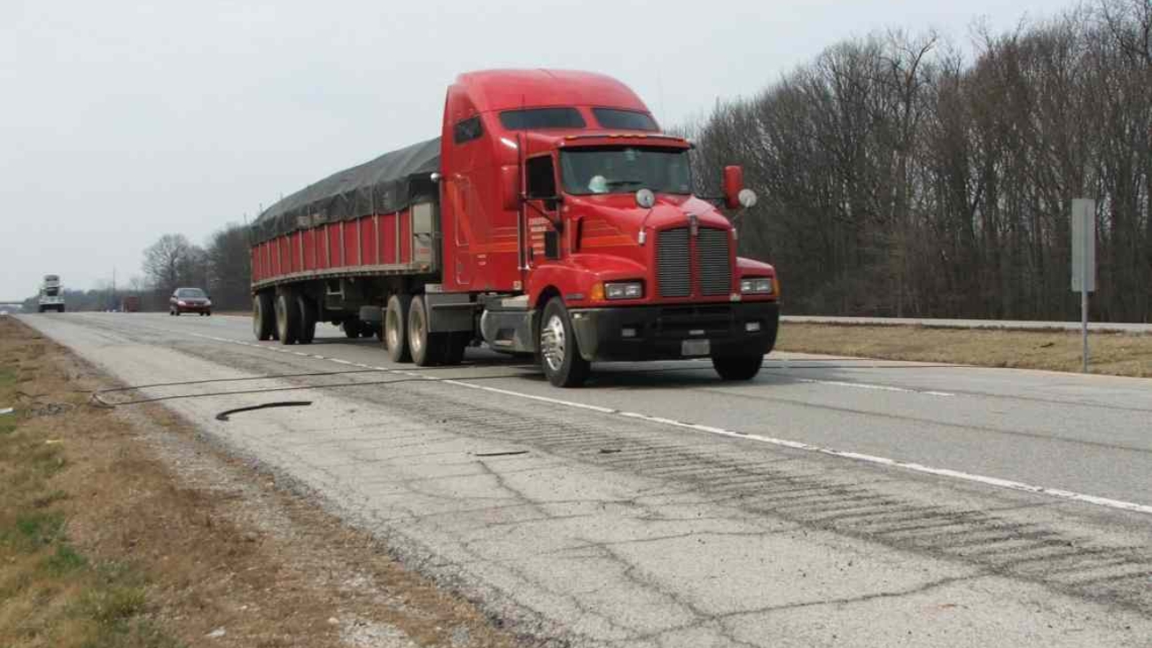
Project Description: This project was an interstate coverage counting assignment along I-469 in Allen County for INDOT’s Traffic Monitoring Section. This assignment involved collecting 48-hour machine counts at sixty-five (65) stations between I-69 and Dupont Road. In addition to completing the necessary fieldwork, United’s counting technicians processed the traffic count data and prepared reports (InForm, PRN Files, PRN Speed Files, and PDF Files) to satisfy current INDOT reporting requirements.
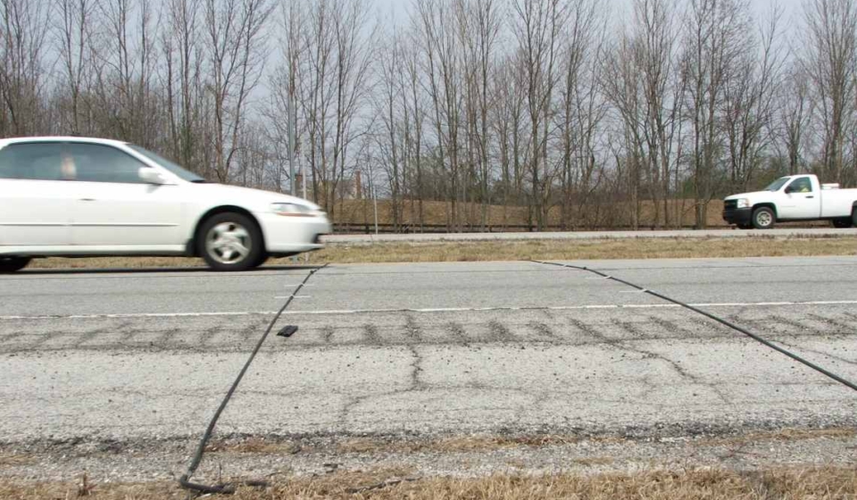
Project Description: An added travel lanes project along a portion of the SR 23 corridor in St. Joseph County was planned by INDOT. In order to assist with the design of this project, traffic projections were requested at 15 intersections for the years 2015, 2012, 2030, and 2032. At these intersections, all inbound legs, including turning movements and outbound legs were considered. The growth rates generated were used to project traffic data from 2008 to 2010, 2012, 2030, and 2032. The traffic data was expressed in terms of average annual daily traffic (AADT), AM and PM design hour volumes (DHV), DHV as a percent of AADT, and the percentage of commercial vehicles for both AADT and DHV.
Project Description: An added travel lanes project along a portion of the US 20 corridor in Elkhart County was planned by INDOT. In order to assist with the design of this project, traffic projections were requested at seven intersections for the years 2015, 2025, and 2035. At the seven intersections, all inbound legs, including turning movements and outbound legs were considered. The growth rates generated were used to project traffic data from 2010 to 2015, 2025, and 2035. The traffic data was expressed in terms of average annual daily traffic (AADT), AM and PM design hour volumes (DHV), DHV as a percent of AADT, and the percentage of commercial vehicles for both AADT and DHV.
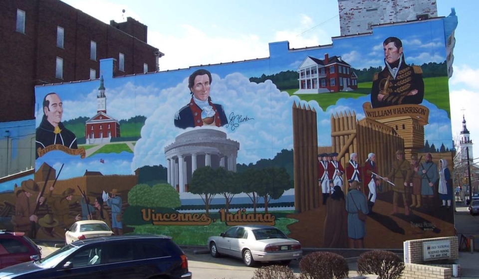
Project Description: The Comprehensive Plan included a detailed inventory of existing conditions, statements concerning city-wide goals and objectives, and an analysis of projected future needs and recommendations to meet or exceed those needs. The Comprehensive Plan is an environmental, physical and social evaluation tool which will provide the City of Vincennes with guidance necessary to achieve pre-determined future goals and objectives. The Comprehensive Plan covers broad topics such as land use, environmental preservation (farmland preservation), housing needs, transportation and other public facilities, economic development, and town facilities (schools, parks, libraries, etc.).
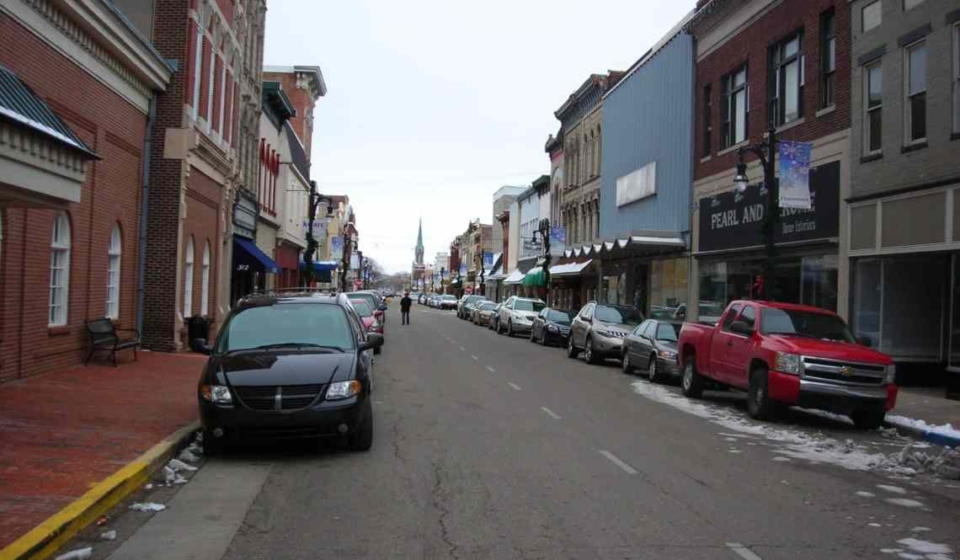
Project Description: Included in the Redevelopment Plan is an assessment and recommendations concerning the following items: downtown business conditions and land use, downtown park improvements, storm and sanitary sewers, electrical and other utility service, concrete curbs, sidewalks, lighting, and pedestrian and vehicular traffic. This project required the organization and facilitation of two public working meetings.
Project Description: This project was an interstate coverage counting assignment along I-69 from Marion County to the Michigan State Line for INDOT’s Traffic Monitoring Section. This assignment involved collecting 48-hour machine counts at 218 stations along this stretch of interstate. In addition to completing the necessary fieldwork, our counting technicians processed the traffic count data and prepared reports (InForm, PRN Files, PRN Speed Files, and PDF Files) to satisfy current INDOT reporting requirements.
Breadth of Services Provided: Traffic Data Collection
Shopping Basket
Cookie Consent
We use cookies to improve your experience on our site. By using our site, you consent to cookies.
Cookie Preferences
Manage your cookie preferences below:
Essential cookies enable basic functions and are necessary for the proper function of the website.
Name
Description
Duration
Cookie Preferences
This cookie is used to store the user's cookie consent preferences.