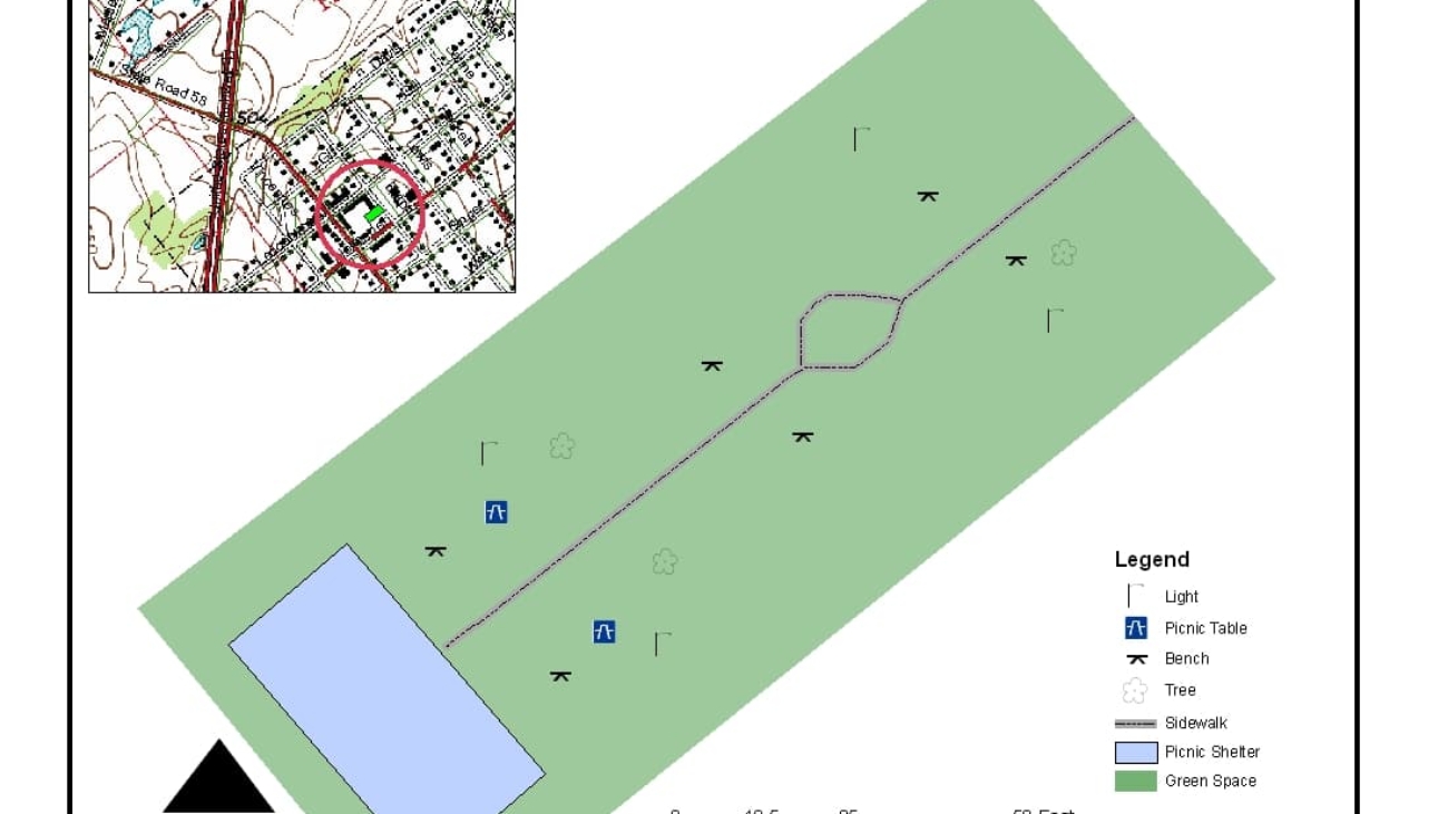
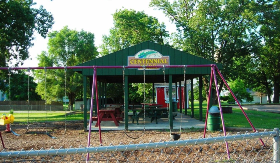
Project Description: The City of Sullivan Five Year Parks & Recreation Master Plan includes provisions for the following: Definition of the Planning Area, Brief History of Parks and Recreation Board/Agency, Goals & Objectives, Marketing Strategies, Supply Analysis, Natural Features & Landscape, Man-Made, Historical, & Cultural Features, Social & Demographic Factors, Economic Factors, Barrier Free Programming and Universal Design. Public Participation, Demand Analysis, Needs Analysis, Priorities, Action Schedule/ Implementation Plan, General Public Meeting on Draft Master Plan, Evaluation Strategy, Park Board Resolution Adopting Plan, and Section 504 Assurance of Compliance.
Project Description: The Town of Carlisle Five Year Parks & Recreation Master Plan includes provisions for the following: Definition of the Planning Area, Brief History of Parks and Recreation Board/Agency, Goals & Objectives, Marketing Strategies, Supply Analysis, Natural Features & Landscape, Man-Made, Historical, & Cultural Features, Social & Demographic Factors, Economic Factors, Barrier Free Programming and Universal Design, Public Participation, Demand Analysis, Needs Analysis, Priorities, Action Schedule/Implementation Plan, General Public Meeting on Draft Master Plan, Evaluation Strategy, Park Board Resolution Adopting Plan, and Section 504 Assurance of Compliance.
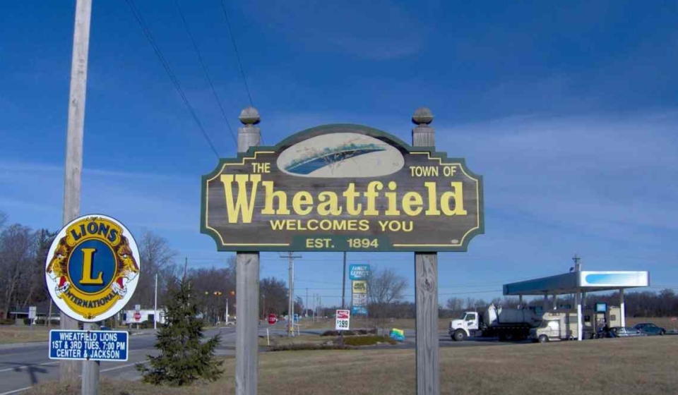
Project Description: The Comprehensive Plan included a detailed inventory of existing conditions, statements concerning town-wide goals and objectives, and an analysis of projected future needs and recommendations to meet or exceed those needs. The Comprehensive Plan is an environmental, physical, and social evaluation tool which will provide the Town of Wheatfield with guidance necessary to achieve pre-determined future goals and objectives. The Comprehensive Plan covers broad topics such as land use, environmental preservation (farmland preservation), housing needs, transportation and other public facilities, economic development, and town facilities (schools, parks, libraries, etc.).
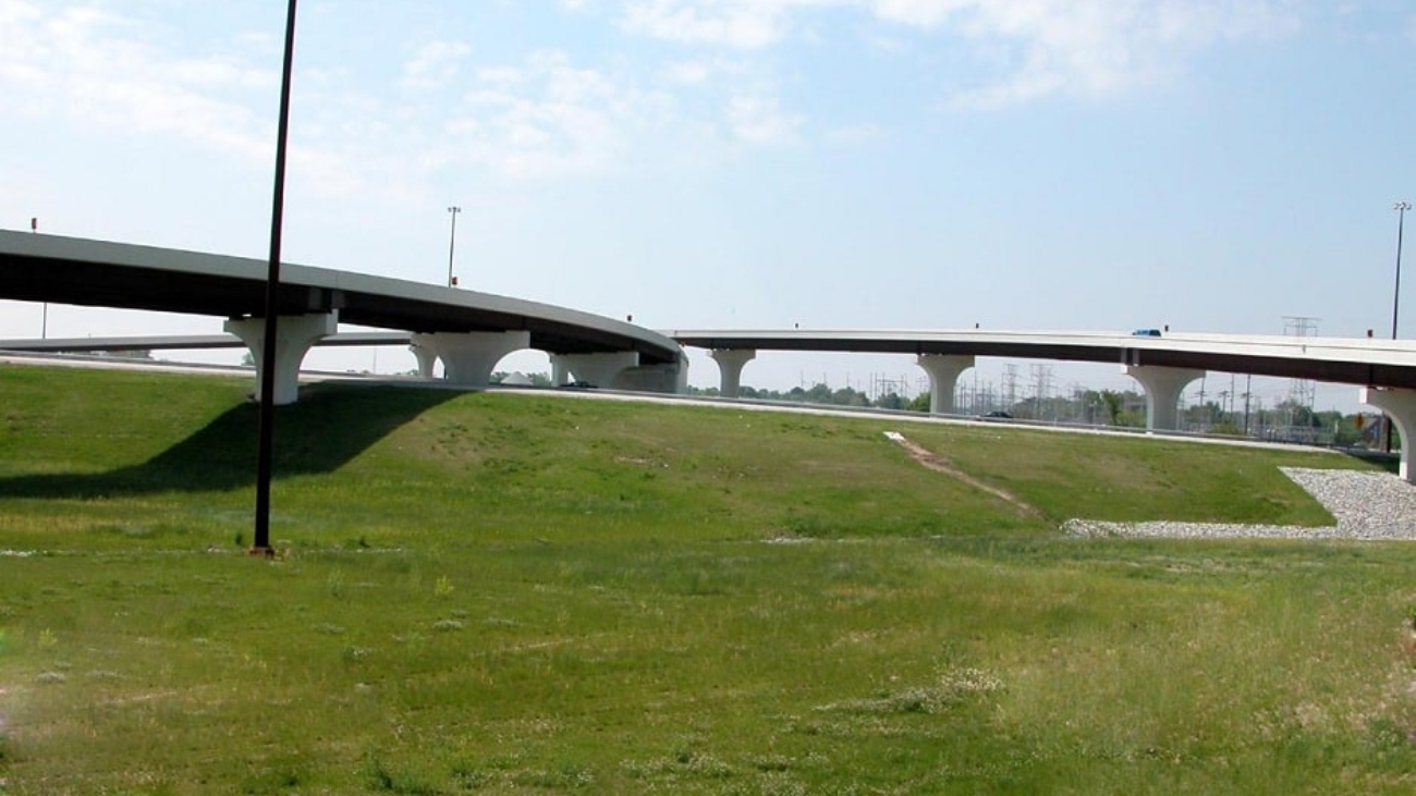
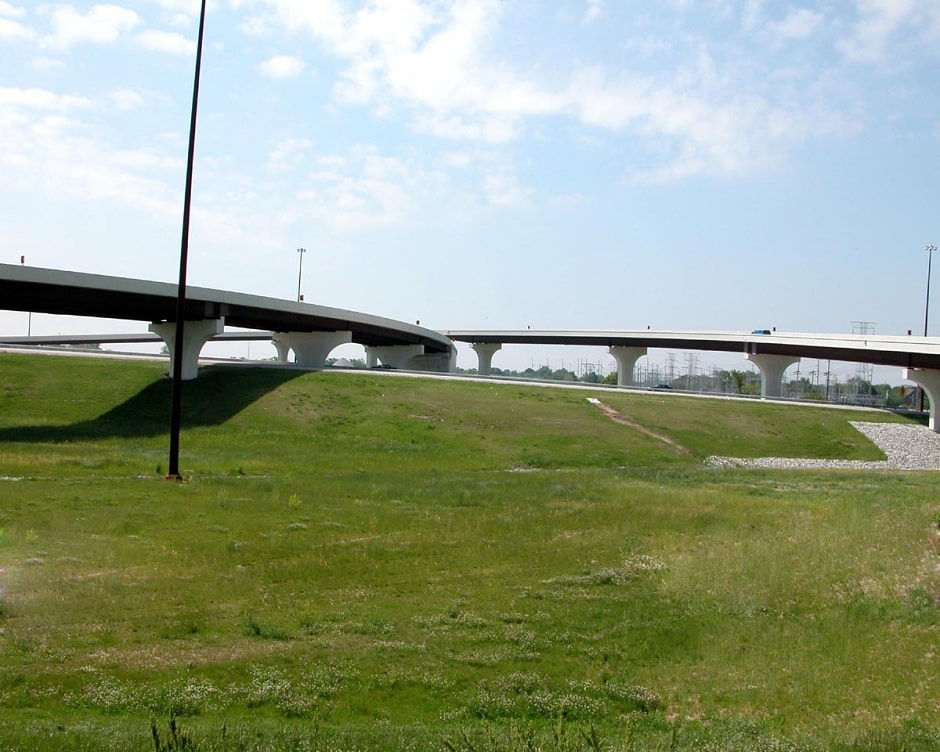
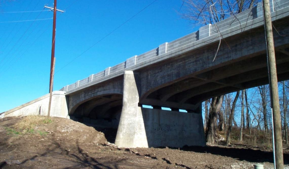
Project Description: With the goal of reducing congestion and improving safety and mobility along the route, United completed preliminary and final design on 15 bridges for the upgrade and realignment of US 31 from US 30 in Plymouth to the US 20 bypass in South Bend. These projects included multiple bridge types from single-span prestressed girders to a three-span steel plate girder structure with integral post-tensioned straddle bent pier caps at a single-point interchange.
United also completed the “Fast Track” rural five-mile Grading Contract and the more complex urban design in the northern two miles. The six different urban Contracts included pavement reconstruction, retaining walls, local road improvements, bridge replacements, signing, signal design, and a single-point urban interchange.
This project is part of the larger Major Moves initiative to upgrade the route to freeway standards from Indianapolis to South Bend.
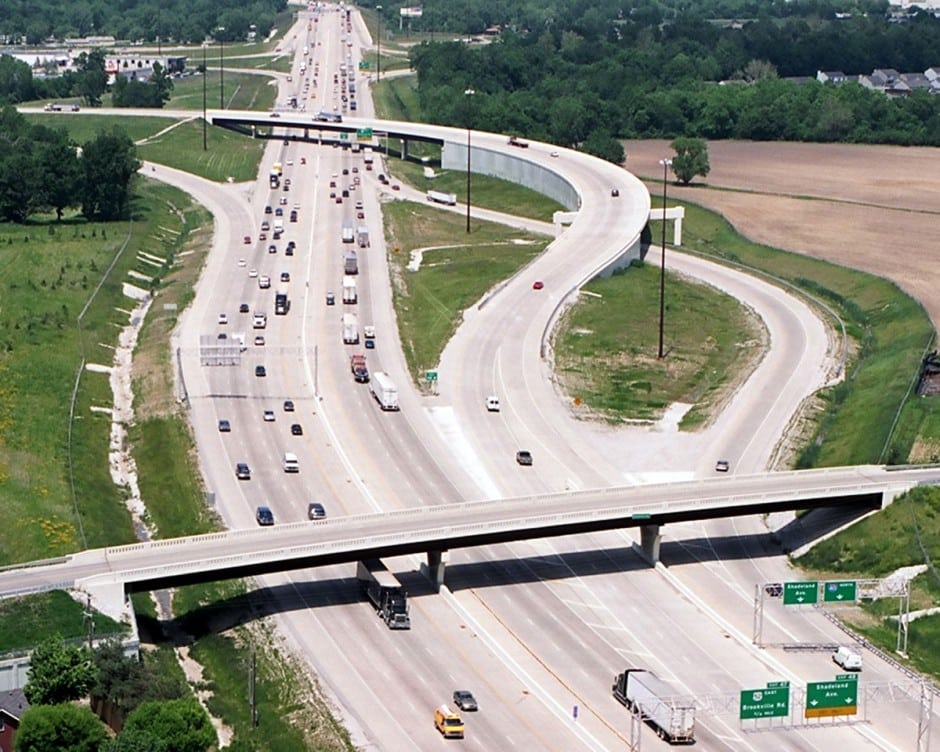
Project Description: The project included the complete reconstruction of the system to system interchange at I-465 and I-74. It also reconstructed the interchange access from I-465 to Brookville Road and Shadeland Avenue. The interchange configuration involved extensive coordination with geotechnical to determine the most cost-effective solutions for the fly-over ramps. It was determined in that longer bridges were more economical than walls due to the existing soil conditions. Maintenance of Traffic was a major component of the design due to the urban environment. Additionally, detention and lift station designs were completed as part of the project to facilitate drainage.
Approximate Project Cost: $74,000,000
Breadth of Services Provided: Regulatory Permit Applications, Roadway Design, and Bridge Design
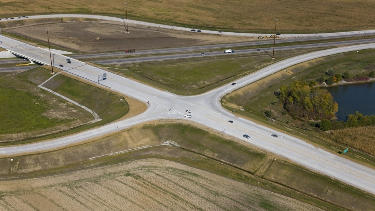
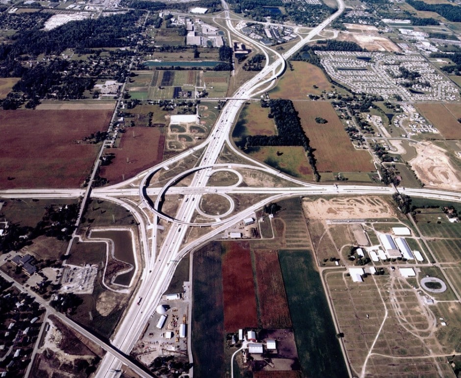
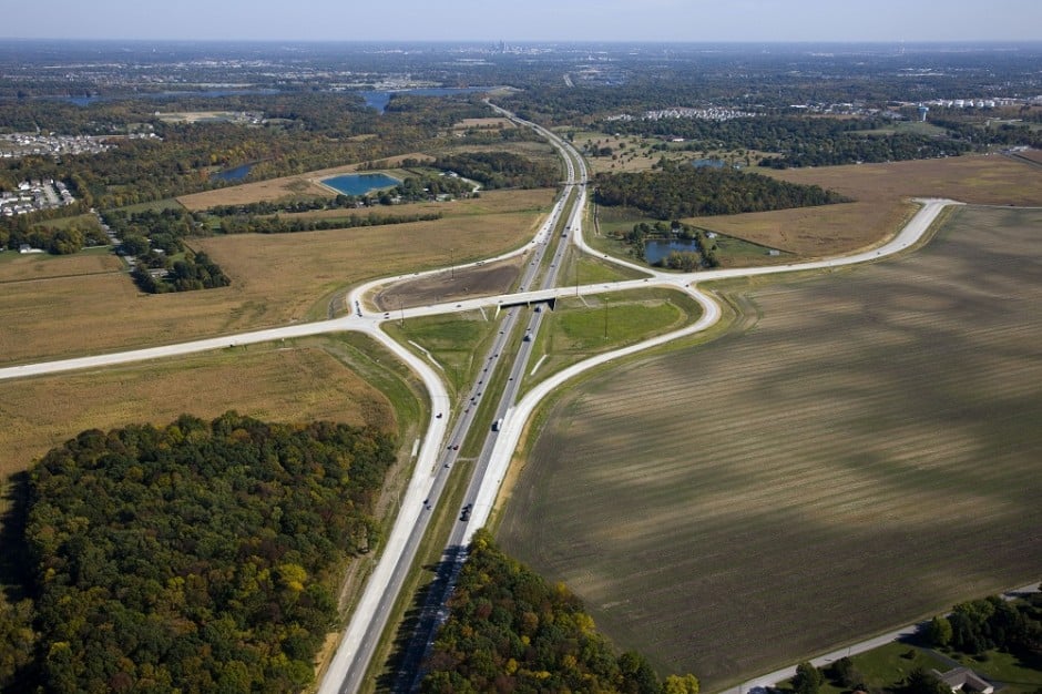
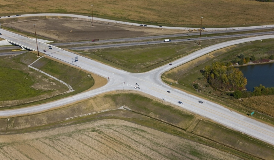
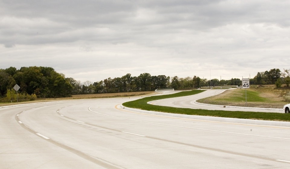
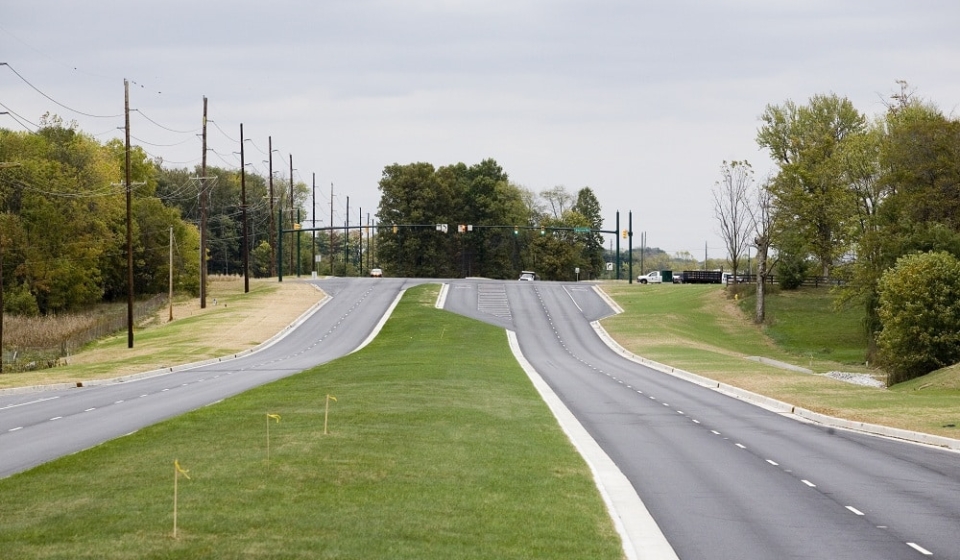
Project Description: The Ronald Reagan Parkway is multi-lane rural arterial from I-70 to I-74, near Hendricks County, Indiana. This FAST TRACK project provides transportation services to this rapidly developing portion of eastern Hendricks County and western Marion County. Connection of the corridor to I-74 is a vital part of the overall traffic/congestion management for Hendricks County and the Indianapolis Metropolitan Area.
This project, in development for just six months, included a new diamond Interchange on I-74 in Hendricks County and nearly two-miles of new alignment roadway construction for the County’s five-lane rural Ronald Reagan Parkway corridor from US 136 to 56th Street (CR 600 N).
The interchange is 2.8 miles east of SR 267. The Ronald Reagan Parkway runs from US 136 (Crawfordsville Road), north to Hendricks County Road 600 North (56th Street).
Approximate Project Cost: $18,000,000
Breadth of Services Provided: Roadway Design, Right-of-Way Engineering, Utility Coordination, Lighting Design, Hydraulic Design, and Permitting
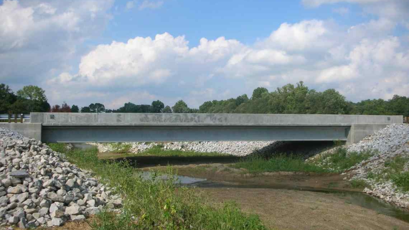
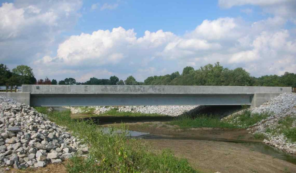
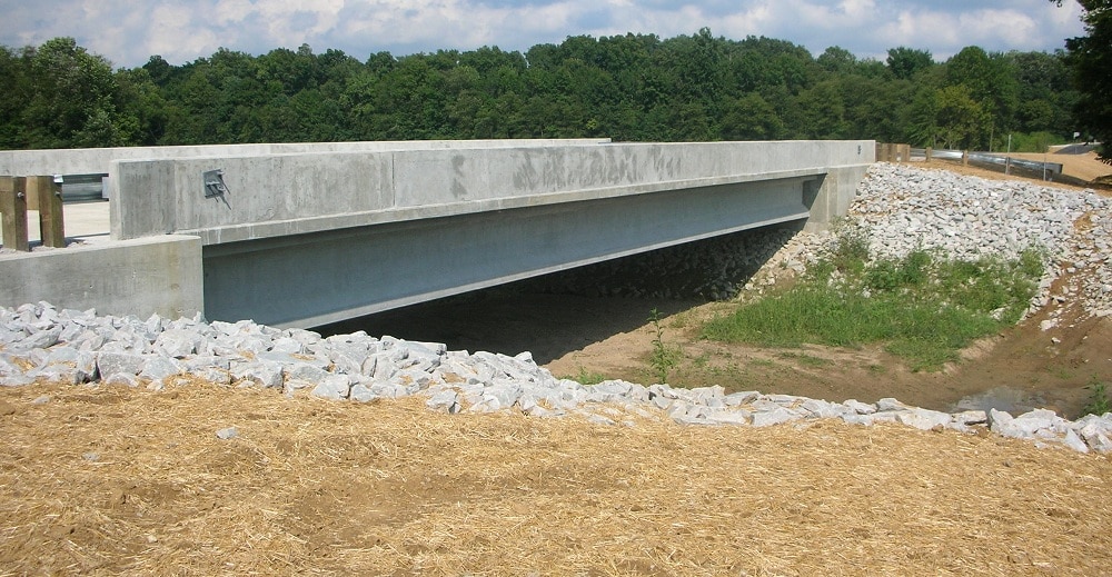
Project Description: This project was the replacement of Sullivan County Bridge No. 297 carrying CR 900 North over Busseron Creek in northern Sullivan County. United Consulting performed all field and office work for the initial property research, collection of data, data processing, and property line calculations for the survey. United Consulting also coordinated title searches and provided transfer documents, legal descriptions, land plats, area computations, existing right-of-way documentation, and right-of-way staking for the four properties for which land was acquired for the construction of the new bridge.
Approximate Project Cost: $750,000
Services Provided: Topographic Survey, Design Survey, Right-of-Way Engineering, and Location Control Route Survey
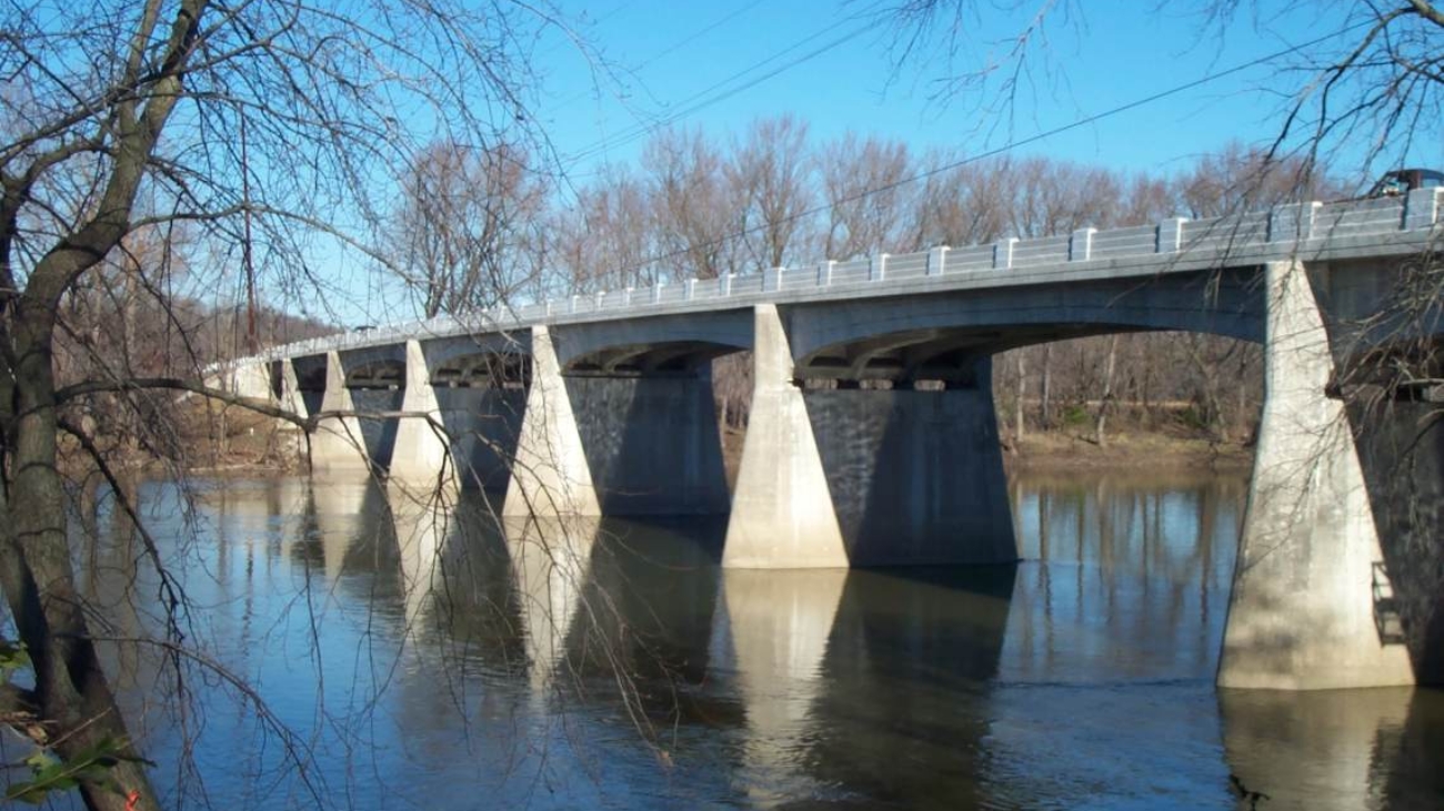
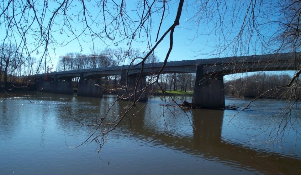
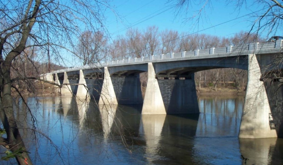
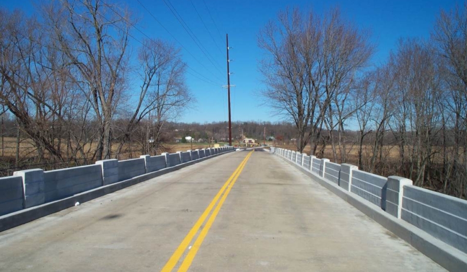
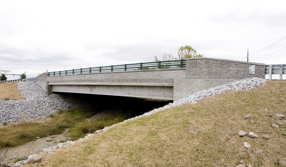
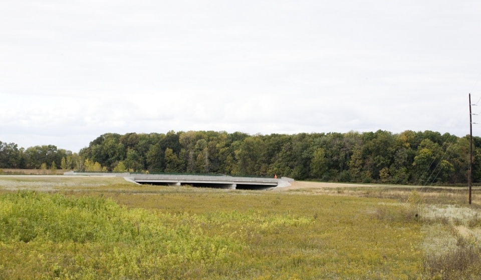
Project Description: The project consisted of the construction of an eight-span, variable depth, reinforced concrete Girder Bridge carrying Carroll CR 250 W over the Wabash River. Project also included a new widened deck slab, end bearing replacement, new expansion joints, replacement of one girder section, and approach improvements. Project necessitated coordinating with the Indiana Department of Natural Resources, Division of Historic Preservation and Archaeology (SHPO), and other Section 106 Consulting Parties to work towards an amicable solution. This coordination was documented in a Memorandum of Agreement (MOA) that became a part of the environmental documentation for the project. In addition to historic concerns, the project also required further coordination and investigation with the U.S. Fish and Wildlife Service to ascertain possible impacts to a Federally endangered mussel. This coordination resulted in special construction techniques to limit any possible impacts to this species.
Approximate Project Cost: $1,100,000
Breadth of Services Provided: Historical Agency Coordination, Environmental Analysis, Bridge Design, Study Report, Right-of-Way Engineering, Land Acquisition Services, and Construction Inspection
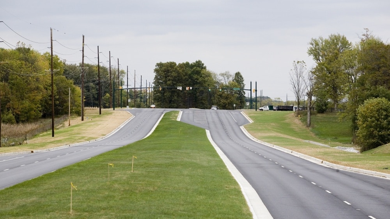
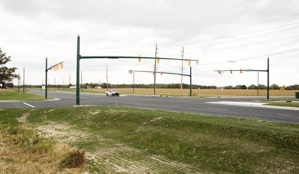
Project Description: 146th Street Extension Project from SR 37 to Boden Road; four-lane urban section designed to allow for future six-lane urban expansion, including landscaped median, multi-use paths, and curb & gutter; three miles of new roadway on new alignment combined with pavement reconstruction and widening, including two bridges.
This roadway extension and added travel lanes project necessitated the completion of an Environmental Assessment. Major environmental services investigated during the completion of this documentation included a noise analysis, wetland determination and delineation. It also included coordinating with the Local MPO to ensure compatibility with the Regional Transportation Plan and air conformity analysis. The project resulted in extensive coordination with the Indiana Department of Environmental Management and the US Army Corps of Engineers due to project impacts upon wetlands. The project resulted in a Section 401 Water Quality Certification from the Indiana Department of Environmental Management and an Individual Permit from the US Army Corps of Engineers.
Approximate Project Cost: $26,000,000
Breadth of Services Provided: Survey, Project Management Services, Roadway Design, Hydraulic Design, Retention Pond Design & Plans, Environmental Services, Regulatory Permit Management, and Construction Inspection
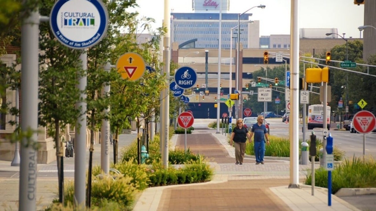
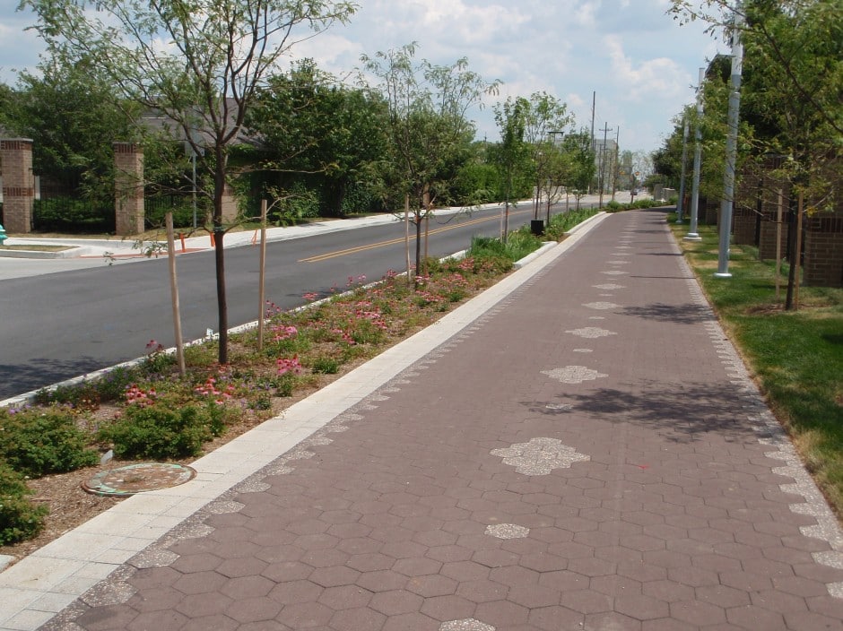
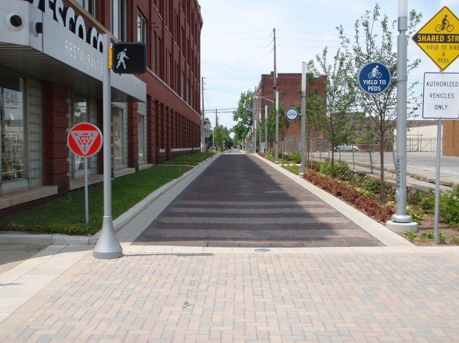
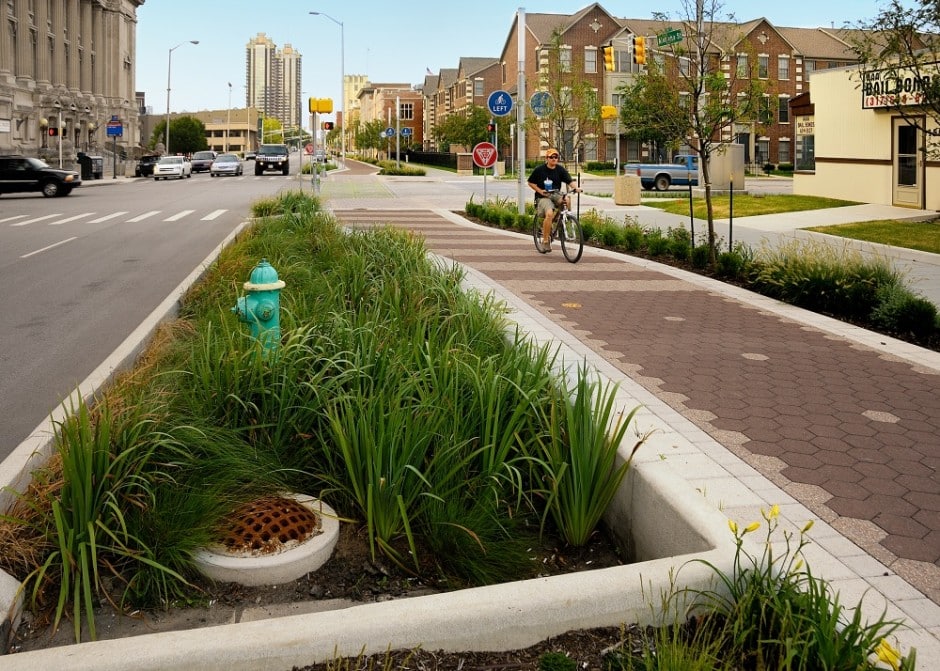
On November 15, 2012, the United Consulting/Rundell Ernstberger Asociates, LLC team received the highest honor at the 35th annual Monumental Affairs Awards Ceremony. The team was awarded the Monumental Award for the Indianapolis Cultural Trail: A Legacy of Gene & Marilyn Glick. The Monumental Award is the highest honor presented at this annual event sponsored by the Indianapolis Chamber of Commerce. United Consulting also received an Honor Award for the Indianapolis Cultural Trail project in the Engineering category.
Project Description: An urban bike and pedestrian path connecting together five downtown cultural districts and the entire greenways system.
This project constructed eight miles of new shared-use paths and sidewalks in and around downtown Indianapolis highlighting adjacent cultural districts, incorporating art into public spaces, and emphasizing green and context sensitive design. Every intersection required careful consideration of the interactions between vehicular, pedestrian, and bicycle traffic.
The project was a collaborative effort by the City of Indianapolis Department of Public Works and Central Indiana Community Foundation.
United’s responsibilities included the design of detailed signing and marking plans, grading plans that included over 13,000 individual spot elevations and drainage design that included heavy usage of storm water planters to help reduce runoff into the City’s combined sewer system.
Approximate Project Cost: $40,000,000
Breadth of Services Provided: Transportation Engineering and Utility Coordination
Shopping Basket
Cookie Consent
We use cookies to improve your experience on our site. By using our site, you consent to cookies.
Cookie Preferences
Manage your cookie preferences below:
Essential cookies enable basic functions and are necessary for the proper function of the website.
Name
Description
Duration
Cookie Preferences
This cookie is used to store the user's cookie consent preferences.