image-259

Indianapolis Cultural Trail

Indianapolis Cultural Trail

Indianapolis Cultural Trail

Client

City of Indianapolis Department of Public Works

Follow Us On

On November 15, 2012, the United Consulting/Rundell Ernstberger Asociates, LLC team received the highest honor at the 35th annual Monumental Affairs Awards Ceremony.  The team was awarded the Monumental Award for the Indianapolis Cultural Trail:  A Legacy of Gene & Marilyn Glick.  The Monumental Award is the highest honor presented at this annual event sponsored by the Indianapolis Chamber of Commerce.  United Consulting also received an Honor Award for the Indianapolis Cultural Trail project in the Engineering category.

Project Description:  An urban bike and pedestrian path connecting together five downtown cultural districts and the entire greenways system.

This project constructed eight miles of new shared-use paths and sidewalks in and around downtown Indianapolis highlighting adjacent cultural districts, incorporating art into public spaces, and emphasizing green and context sensitive design. Every intersection required careful consideration of the interactions between vehicular, pedestrian, and bicycle traffic.

The project was a collaborative effort by the City of Indianapolis Department of Public Works and Central Indiana Community Foundation.

United’s responsibilities included the design of detailed signing and marking plans, grading plans that included over 13,000 individual spot elevations and drainage design that included heavy usage of storm water planters to help reduce runoff into the City’s combined sewer system.

Approximate Project Cost:  $40,000,000

Breadth of Services Provided: Transportation Engineering and Utility Coordination

image-253

62nd Street Multi-Use Path

62nd Street Multi-Use Path

62nd Street Multi-Use Path

Client

City of Indianapolis Department of Public Works (DPW)

Follow Us On

Project Description:  This project provides much needed pedestrian and bicycle connectivity between Keystone Avenue and Allisonville Road.  Prior to the construction of the trail, bicycle and pedestrian traffic had to use the side of the roadway.  This new trail provides an easy access for users to reach other trails in the area as well as to reach nearby commerce.

This project runs through the front yard easements of more than 50 houses and provides a safe location for commuters and recreational use by the installation of a 10 foot multi-use path.  This project was designed to fit within the existing right-of-way and to accommodate a meandering trail alignment to blend with the neighborhood.

The pathway extends along the south side of 62nd Street. The total project length was 1.35 miles.  The existing right turn lane on 62nd Street between Keystone Avenue and Rural Street was removed to allow space for the proposed multi-use path.  A buffer varying in width from four feet to 22 feet was established between the roadway and the multi-use path.  Additionally, ADA compliant curb ramps and cross walk striping were constructed at each of the major intersections.

From a recent Indianapolis Star article, one resident of the area stated “It’s opened up a whole new way of getting around.  It’s the greatest thing.”  The resident went on to say, “I was worried about strangers, but it seems like such an active, family environment.  We love it.”

Approximate Construction Cost:  $1,400,000

Breadth of Services Provided:  Transportation Engineering

image-250

I-469 Between I-69 and Dupont Road, Allen County

I-469 Between I-69 and Dupont Road, Allen County

I-469 Between I-69 and Dupont Road, Allen County

Client

Indiana Department of Transportation (INDOT)

Follow Us On

Project Description:  This project was an interstate coverage counting assignment along I-469 in Allen County for INDOT’s Traffic Monitoring Section.  This assignment involved collecting 48-hour machine counts at sixty-five (65) stations between I-69 and Dupont Road.  In addition to completing the necessary fieldwork, United’s counting technicians processed the traffic count data and prepared reports (InForm, PRN Files, PRN Speed Files, and PDF Files) to satisfy current INDOT reporting requirements.

Breadth of Services Provided:  Traffic Forecasting

image-249

SR 23 Added Travel Lanes, St. Joseph County

SR 23 Added Travel Lanes, St. Joseph County

SR 23 Added Travel Lanes, St. Joseph County

Client

Indiana Department of Transportation (INDOT)

Follow Us On

Project Description:  An added travel lanes project along a portion of the SR 23 corridor in St. Joseph County was planned by INDOT.  In order to assist with the design of this project, traffic projections were requested at 15 intersections for the years 2015, 2012, 2030, and 2032.  At these intersections, all inbound legs, including turning movements and outbound legs were considered.  The growth rates generated were used to project traffic data from 2008 to 2010, 2012, 2030, and 2032.  The traffic data was expressed in terms of average annual daily traffic (AADT), AM and PM design hour volumes (DHV), DHV as a percent of AADT, and the percentage of commercial vehicles for both AADT and DHV.

Breadth of Services Provided:  Traffic Forecasting

SANYO DIGITAL CAMERA

Wabash NE Sewer Separation Project

Wabash NE Sewer Separation Project

Wabash NE Sewer Separation Project

Client

City of Wabash, Indiana

Follow Us On

Project Description:  The project included construction of approximately 10,000 feet of 12-inch to 30-inch storm sewer and approximately 1,500 feet of sanitary sewer for sewer separation and reduction of CSO volumes to Charley Creek. Approximately 2,000 feet of storm sewer was located within pavement of SR 13 and involved significant coordination with INDOT and utilities. United assisted the City in obtaining the IOCRA Grant and other financing for the project.

Approximate Project Cost:  $1,500,000

Breadth of Services Provided:  Planning, Survey, Design Engineering, Permitting, Land Acquisition, Bidding Services, and Construction Administration

image-248

US 20 Added Travel Lanes, Elkhart County

US 20 Added Travel Lanes, Elkhart County

US 20 Added Travel Lanes, Elkhart County

Client

Indiana Department of Transportation (INDOT)

Follow Us On

Project Description:  An added travel lanes project along a portion of the US 20 corridor in Elkhart County was planned by INDOT.  In order to assist with the design of this project, traffic projections were requested at seven intersections for the years 2015, 2025, and 2035.  At the seven intersections, all inbound legs, including turning movements and outbound legs were considered.  The growth rates generated were used to project traffic data from 2010 to 2015, 2025, and 2035.  The traffic data was expressed in terms of average annual daily traffic (AADT), AM and PM design hour volumes (DHV), DHV as a percent of AADT, and the percentage of commercial vehicles for both AADT and DHV.

Breadth of Services Provided:  Traffic Forecasting

image-247

Vincennes Comprehensive Plan

Vincennes Comprehensive Plan

Vincennes Comprehensive Plan

Client

City of Vincennes

Follow Us On

Project Description:  The Comprehensive Plan included a detailed inventory of existing conditions, statements concerning city-wide goals and objectives, and an analysis of projected future needs and recommendations to meet or exceed those needs.  The Comprehensive Plan is an environmental, physical and social evaluation tool which will provide the City of Vincennes with guidance necessary to achieve pre-determined future goals and objectives.  The Comprehensive Plan covers broad topics such as land use, environmental preservation (farmland preservation), housing needs, transportation and other public facilities, economic development, and town facilities (schools, parks, libraries, etc.).

image-242

Clinton Downtown Redevelopment Plan

Clinton Downtown Redevelopment Plan

Clinton Downtown Redevelopment Plan

Client

City of Clinton

Follow Us On

Project Description:  Included in the Redevelopment Plan is an assessment and recommendations concerning the following items: downtown business conditions and land use, downtown park improvements, storm and sanitary sewers, electrical and other utility service, concrete curbs, sidewalks, lighting, and pedestrian and vehicular traffic.  This project required the organization and facilitation of two public working meetings.

DCIM100MEDIADJI_0106.JPG

SR 11 at I-65 Interchange is Now Open!

SR 11 at I-65 Interchange is Now Open!

United Consulting

November 21, 2020 l UPDATED POST

Motorists traveling along the I-65 Southeast (SE) Corridor in Jackson County have a lot to be thankful for this year  — the SR 11 Interchange at I-65 Safety Improvements project opened on Saturday, November 21, ending a three-month closure just in time for Thanksgiving. 

Although not included in the original scope of the $143 million, Best Value Design Build I-65 SE project between the I-65 Exit 50 (US 50) and Exit 64 (SR 58), the SR 11 at I-65 Interchange put the finishing touches on the 14 miles of newly transformed roadway. The interchange was added to the I-65 SE contract after the project had already begun, resulting in a safer interchange that was more economical and completed in a shorter time frame by using the same contractor and contract that was already in place for the corridor improvement.

The newly reconfigured interchange provides much-needed safety enhancements by facilitating smoother traffic movements through the area. The interchange allows easy on/off access between I-65 and SR 11 through the use of a double roundabout configuration which is also known as a dog bone (see photo above).

INDOT posted a video to their YouTube channel which illustrates how to navigate the new interchange. Click to watch the video. 

ORIGINAL POST l September 8, 2020 l Seymour, IN

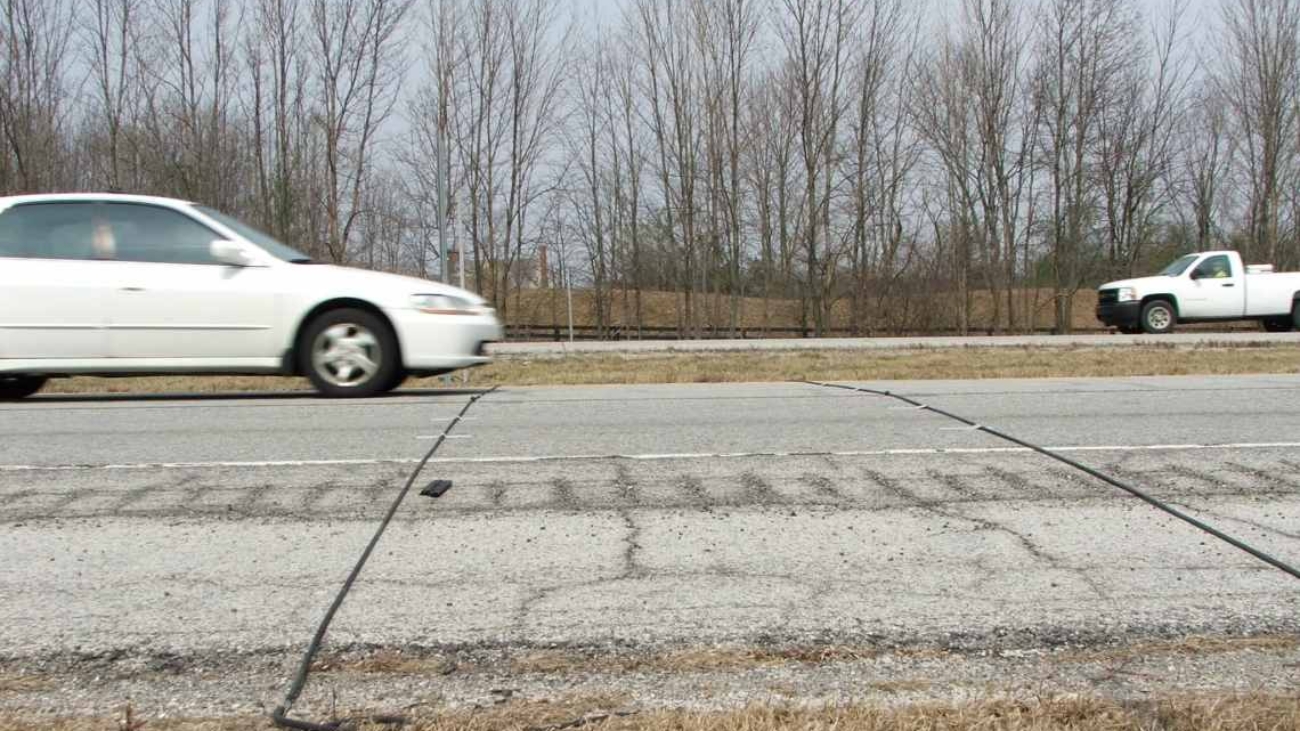
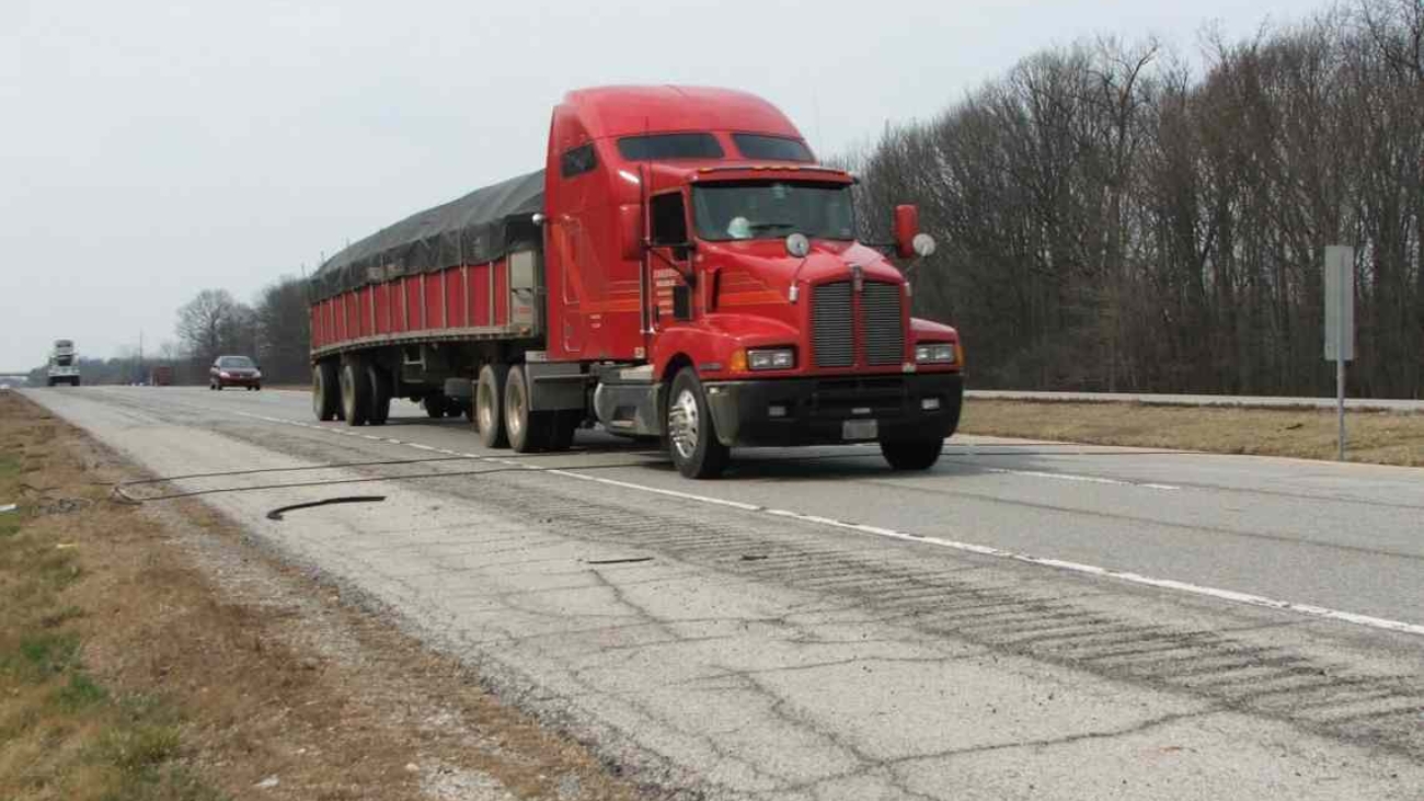
I-65 SE — Perfect Day for a Ribbon Cutting!


INDOT Commissioner Joe McGuinness, local government officials, and E&B Paving Area Manager Spencer Coe hosted a ribbon cutting ceremony at the northbound weigh station near Seymour on Tuesday, September 8th to officially open the I-65 Southeast Indiana corridor between Seymour and Columbus. The project is substantially complete with the exception of the SR 11 Interchange which was added to the project scope after the project had already begun construction.


The $143 million, Best Value Design Build project between I-65 between Exit 50 (US 50) and Exit 64 (SR 58) transformed 14 miles of the original four-lane facility into a six-lane facility to improve travel and safety conditions for motorists. Seventeen bridges, eight twin bridges carrying mainline I-65 over rivers and creeks, two twin bridges over railroads, and seven bridge overpasses of I-65 were also included in the project.


The E&B Paving / United Team was selected as the Preferred Proposer in May 2017 after going through a rigorous submittal process and proposing a solid, well thought-out plan that exceeded INDOT’s scoring criteria, providing several added-value elements to the project scope.


Kudos to E&B Paving on your exceptional work in providing extra-smooth pavement for the project!

Recent Posts

Follow Us On

Shopping Basket